Heavy rain and localized flooding expected, most notably in eastern areas
A storm system will move from a position near Alabama and Georgia Friday night and tracks up the US Eastern Seaboard Saturday, staying just east of the Appalachians. It will move rather quickly, but will be potent as northern stream energy in association with a trough interacts with the system. Since it will be too warm for snow, the precipitation type will be rain predominantly for most areas, although the highest elevations over 2,000 ft AGL may begin as a brief wintry mix late Friday night initially before quickly changing to rain. The storm will reach the New York City latitude by late afternoon, and precipitation will quickly come to an end by late afternoon Saturday in most areas, but may linger to around dinnertime in far eastern/coastal areas and Northeastern New Jersey neat the NYC metro.
CLICK ON ANY IMAGE IN THIS ARTICLE TO ENLARGE FOR BETTER VIEWING
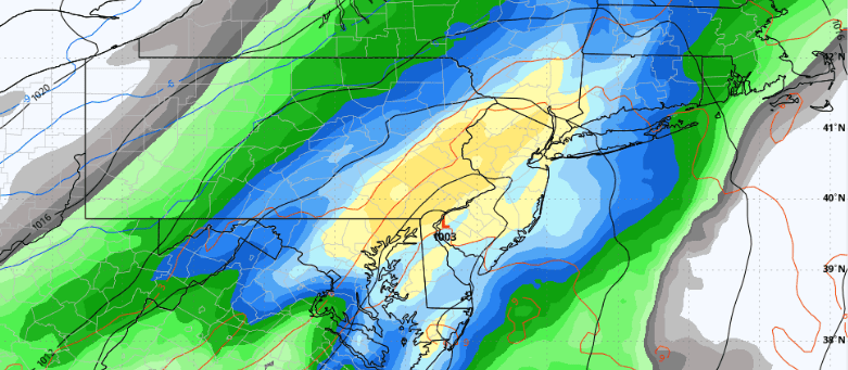
The broad evolution of this system from the European guidance shows the primary low tracking from the Southern US up the US Eastern Seaboard Friday night and Saturday, with heavy rain nearest low pressure
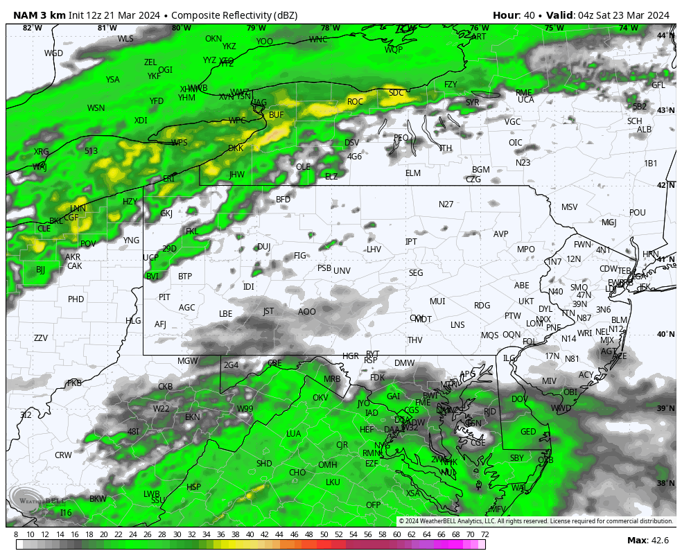
Taking a closer look at our region specifically, the 3km NAM future simulated radar indicates rain showers will begin after midnight for most areas, and then evolves into steady periods of rain near dawn Saturday. Rain will be heavy at times as indicated by the yellow/orange/red colors on the radar simulation below, and the heaviest rain will occur during the day on Saturday:
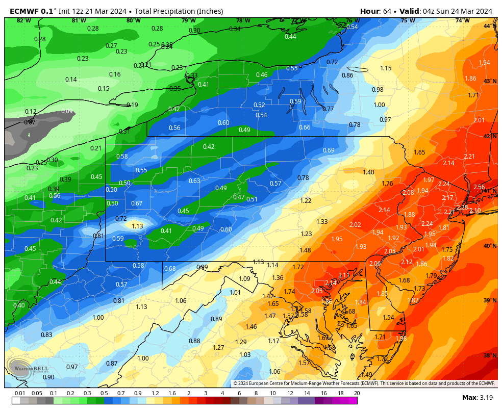
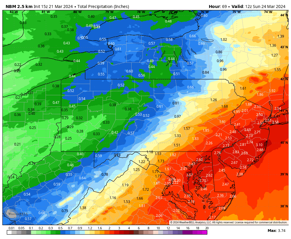
In terms of total precipitation, there are some variances with rain totals, but the majority of guidance is fairly similar on track and synoptic evolution. As a general rule, 50 miles on either side of the I-95 corridor is likely to see the heaviest swath of rain, and the global models are generally showing that heaviest swath to be anywhere between 1.75-2.50″ of rain, which we feel is a realistic estimate. Farther to the northwest of the low track and beyond the 50 mile point NW of I-95, there is a step down in precipitation amounts. This means areas expected to see the highest amounts of rain in the 1.75-2.50″ range are places like Newark. Trenton, Morristown, Toms River, Atlantic City, Cape May, and Camden, NJ. Wilmington, Dover, and Georgetown, DE. The Lehigh Valley, Reading, Lancaster, and Philadelphia. PA and surrounding suburbs. Baltimore, Washington, and the Eastern Shore of MD. Places like Wilkes-Barre, Scranton, Pottsville, Lebanon, Harrisburg, and York can expect less, but still 1.00-1.75″ of rain. All other areas even farther NW like State College, Williamsport, Lock Haven, and Selinsgrove can expect between 0.50-1.0″ of rain from this event.
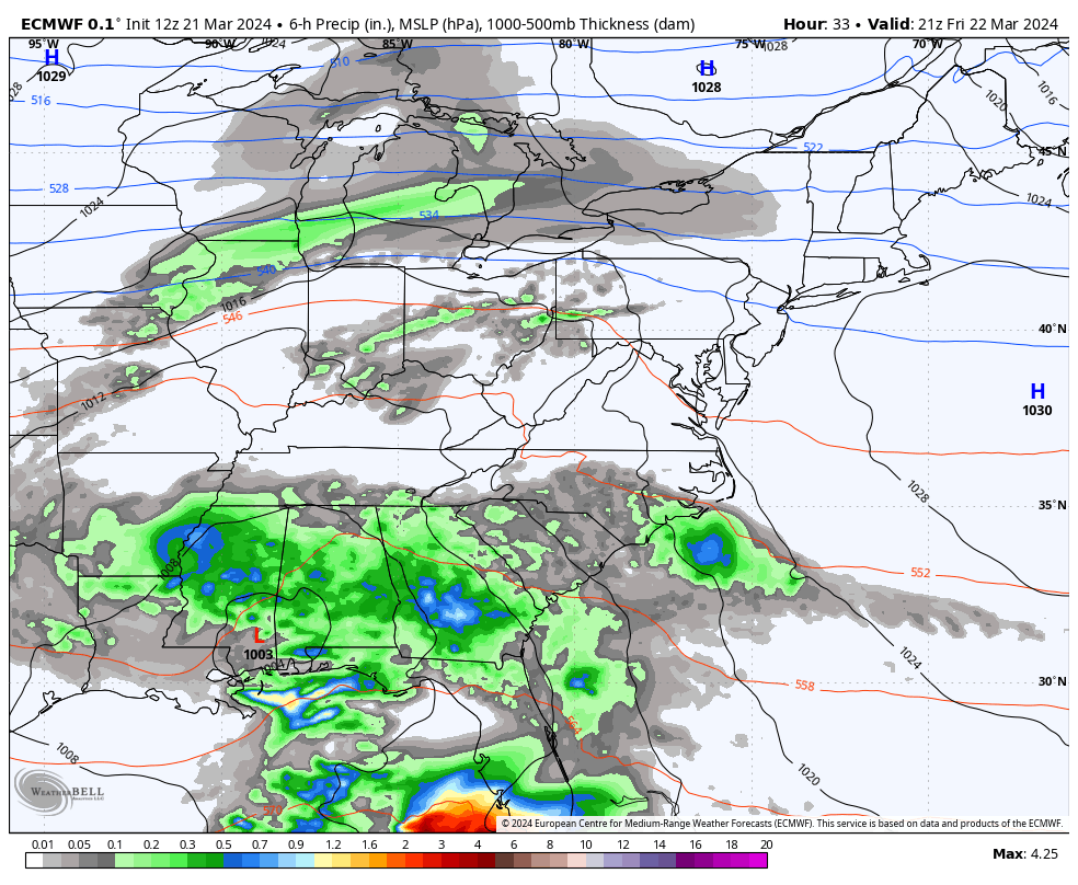
The European model guidance for this event shows the heaviest rainfall occurring in our eastern and southeastern areas most notably, where 1.75-2.50″ of rain is expected in the heaviest axis 50 miles or so on either side of the I-95 corridor
The National Blend of Models (NBM 2.5km) is a little but higher with the top end of ranges of precipitation than most, but this is largely due to blending in mesoscale short range guidance that was not specifically designed or intended for rainfall estimates in synoptic systems such as these:
Wind is not expected to be too much of a concern with the system itself, but it does turn a bit breezy after the system exits, generally 15-25mph with some gusts 30-35mph Saturday evening. But this will occur after the precipitation has ended. The breezy conditions are a result of a developing pressure gradient caused by proximity of low pressure exiting to the east and high pressure moving in behind.
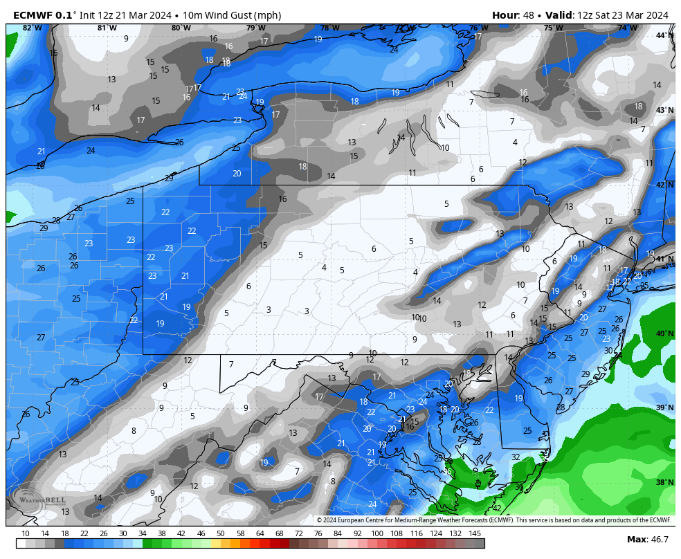
The European model guidance for this event shows the highest wind following this system, and largely not during the periods of heavier rainfall. Wind gusts 15-25mph and peaks 30-35 can be expected Saturday evening most notably as the system exits
