

Spring equinox officially arrives on March 19th at 11:06 PM EDT
Some like to recognize the start of Meteorological Spring on the first day of March, but astronomical Spring will officially arrive at 11:06 PM EDT on March 19th, 2024. At that time, we will be more than a week past Daylight Savings Time (DST) with the Sun now setting well past 7:00 PM. Plants, grass, and some vegetation in some cases have starts to grow, and trees will be budding soon enough if they haven’t started already where you live. It has been quite warm (overall) for the much of the first half of March, but according to our long range outlooks, updated every Friday here on this website at https://epawaweather.com/long-range-outlook/, parts of the 2nd half of the month will remind us that is still March after all, and Winter will be reluctant to let go easily.
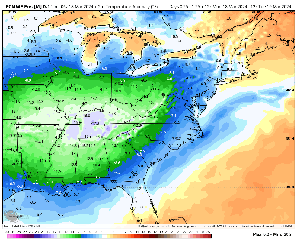
According to the European Ensemble and our long range outlook projections, the very warm temperatures seen this week will be replaced with notably cooler than average temperatures next week, most notably March 18th-19th, and again March 21st thru the weekend
These temperatures will of course be relative to average high and low temperatures at that time, which means we’re not talking about 20s and 30s for highs in this case. Normal high temperatures for our major climate sites over the next 6 weeks can be found on the chart below:

While the temperatures will be below average March 18th-19th, and again from around the 21st through the weekend, it will be relative to average highs and lows at that time. In this case, most guidance suggests that for a few days next week, highs will be some 5-8° below average, and relative to normal highs that are generally between 49-54° from NW-SE across our territory. At the tail end of the month, it is likely only slightly below average. Colder sure…but keeping things in perspective, this isn’t cold enough for snow unless a perfectly timed and tracked thread-the-needle scenario would be necessary to produce a snow event. For most of our area outside of northern/interior areas and elevations, the chances are even less. Stranger things have happened before, and Spring snows are not without precedent. But timing is critical to snow accumulations that will be easier to happen if it were at night, and a dynamic cooling element would be necessary for southern and southeastern/coastal areas. Right now there are no credible “foreseeable” threats.
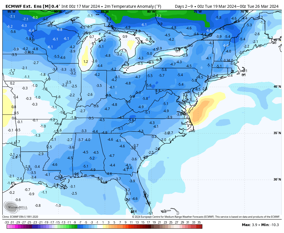
The European Extended shows cooler than average temperatures remaining in place through the end of March and at least the first week or two of April, but the most notable below average temperatures will be found near and the few days after the Spring equinox
Temperatures will likely remain on the cooler side of average to at least begin April, but these temperatures shown are only very slightly below average at that time. An increase in average temperatures each week of around 3.0°F in April will again make “slightly below” relative, coming at a time when normal highs increase from the mid-upper 50s in early April to the lower 60s by mid-month.
With a transition to La Niña late Spring into this Summer, we may be in for hotter and drier conditions as is typically the case in La Niña Summers, and a more active Atlantic hurricane season.
