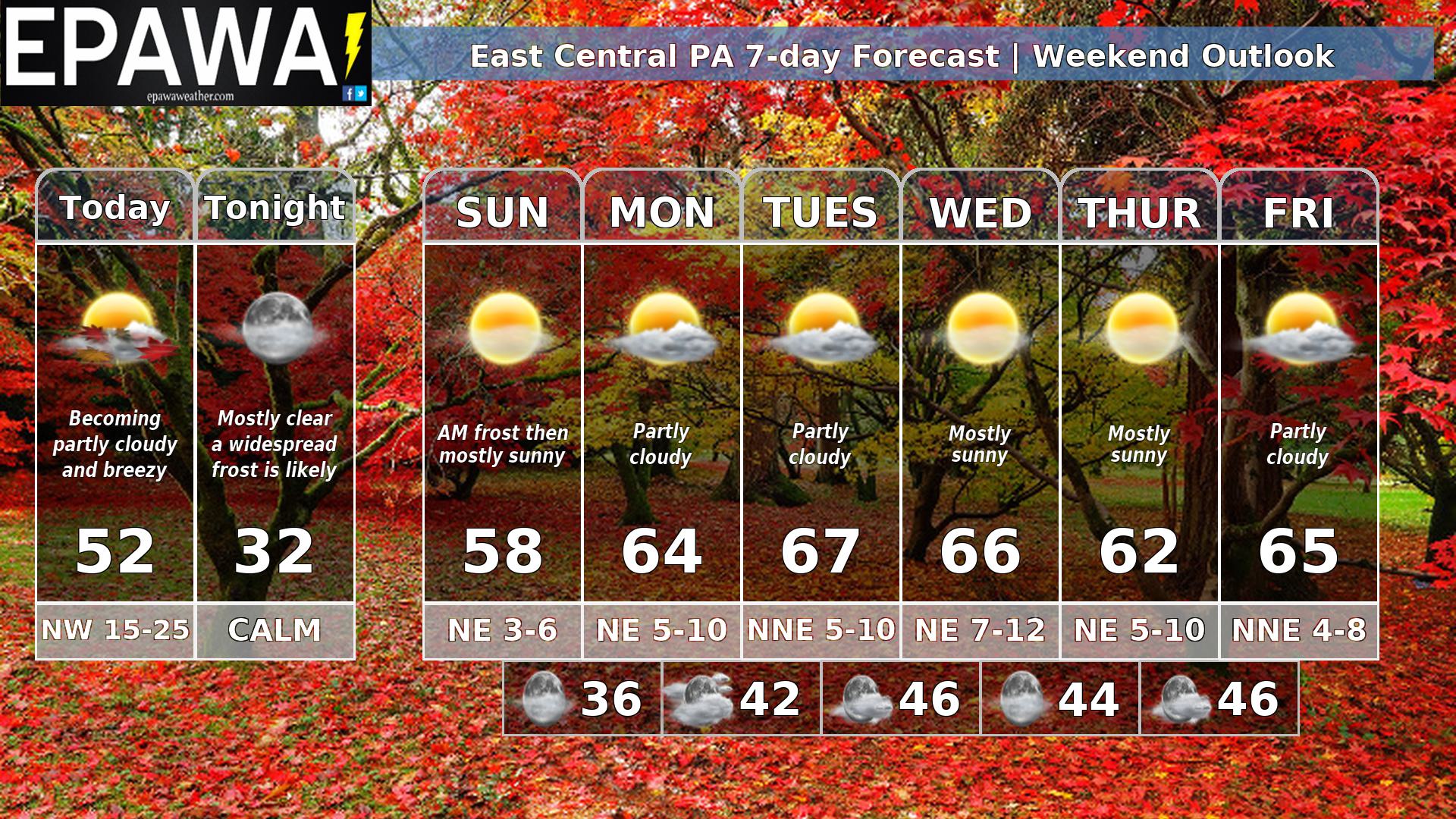
A chilly weekend and blustery Saturday…
Dry conditions are likely over the weekend, but with unseasonably chilly temperatures that will be more November-like, as well as a breezy day expected Saturday. Any morning clouds give way to sun Saturday, then mostly clear overnight with near-freezing temps and a widespread frost. Mostly sunny skies Sunday after a cold start.
The transient trough begins to lift out Monday with moderating temperatures, and that trend is likely to continue through midweek. We are going to keep an eye on an offshore low that is modeled to sit and spin for several days offshore with no direct impacts to this region, but too close for comfort to not at least pay attention to it.
Forecaster: Martrich 17 October 0300z