Our Northeast PA forecast region includes Scranton, Stroudsburg, Hazleton, Williamsport, Bloomsburg, Wilkes-Barre & surrounding areas. Forecasts are updated daily M-F and Saturday that covers both weekend days – not Sunday.
Daily Forecast Video
Daily Forecast Discussion
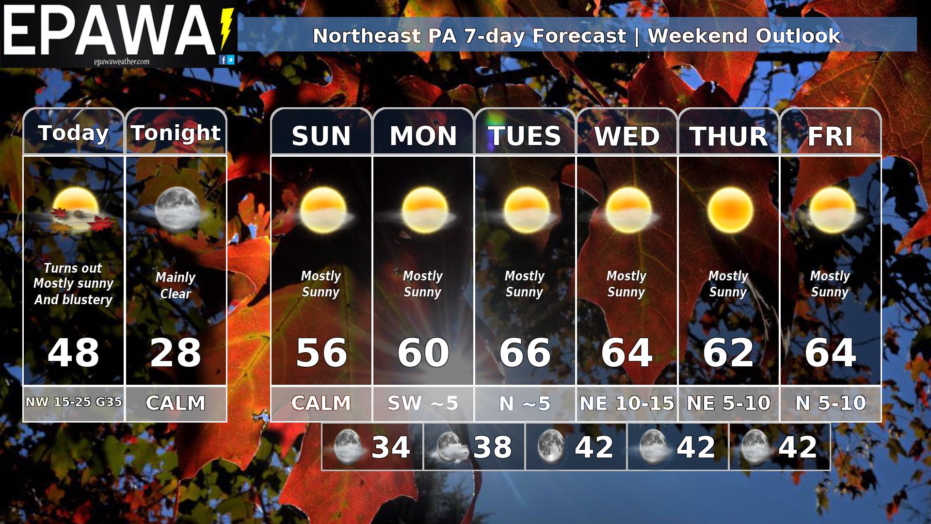
Clouds Saturday morning will give way to mostly sunny skies as we head through the afternoon it’ll be windy into the early afternoon hours the winds will quickly diminish later this afternoon and this evening going to calm before midnight. After that we have a string of mostly sunny, comfortable days with slowly moderating temperatures back to about seasonal average by Tuesday. Dry, sunny and seasonable weather continues through the week
Forecaster: Rinaldi 17 October 0205Z
Average high
Average low
Record high temp (year)
Record low temp (year)
63°F
43°F
84°F (1946)
29°F (1944)
*Climatology information is based off of Scranton/Wilkes-Barre, PA