
Technical discussion below will feature two (2) subcategories: Precipitation, and Pattern Discussion. Storm possibilities will be discussed exclusively in the Premium Forum with intense model analysis leading up to any major snow, ice, or rain events, not publicly. To join this discussion and hear the updated thoughts from our team, click on the MPM image below to go to the MPM information/sign-up page and select the “Premium Weather Forum” option.

Precipitation Discussion
OVERVIEW: After February finished on the slightly drier side of average, March has turned wetter once again over the first week or so relative to average. The remainder of March using longer range ensembles and global trends suggests a near average precipitation departure, with perhaps some slightly drier conditions coming in toward the latter part of the month. For March as a whole. we adjusted projections slightly for a near to slightly above average precipitation (+0.0″ to +1.0″) departure for the month as a whole, but given the milder temperatures expected for a better part of the first three weeks of the month, snowfall expectations are below average or none at all. There is a chance for some far interior snow that is timed just right during the expected colder period, but with warming temperatures past the equinox, a perfect thread-the-needle scenario would be necessary to produce a snow event for areas elsewhere…most notably in southern and southeastern/coastal areas. It has happened before, so it is worth monitoring. But at this point, no distinct winter storm signals are identifiable. Our projection for month of April was maintained this week for a near average (-0.5″ to +0.5″) precipitation departure, with below average or no snowfall.
Shorter term, a system will move through the region from Saturday afternoon through the overnight, with the heaviest rain occurring Saturday evening. Rain amounts will be close to an inch with this event, which is the 3rd rain event this week alone. Behind this system, it turns quite windy in the Sunday-Monday time frame, but absent of precipitation sans a few lake effect snow showers in the far northern tier on Sunday afternoon. Strong ridging mid-late week with warm temperatures ahead of the next cold front, which arrives in the Friday night to Saturday time frame with rain showers, then a reinforcing cold front on the lead of a deeper trough will arrive late next Sunday or Sunday night into the following Monday. There could be some rain/snow showers associated with this front and the upper level trough, and we will monitor in the week ahead.
Our projection for the month of March as a whole was adjusted this week for a near slightly above average (+0.0″ to +1.0″) precipitation (or liquid equivalent) along with below average snowfall…or for some areas, none at all. After beginning the month on a wet note, things look to settle down a bit and will be closer to average once we get past this weekend. The month of April as a whole projections were maintained this week for a near average (-0.5″ to +0.5″) precipitation departure, and we expect below average snowfall or none at all – which typically isn’t much to begin with in April.
Breakdown of precipitation departures from normal over the next several weeks:
March 9th – March 15th: Slightly above average
March 16th – March 22nd: Near average
March 23rd – March 29th: Near to slightly below average
March 30th – April 5th: Slightly above average
April 6th – April 12th: Near average
April 13th – April 19th: Near average
Public/free available maps will be updated when a threat is imminent for significant weather on the weather alerts page throughout the year: http://epawaweather.com/weather-alerts/


Pattern Discussion
OVERVIEW: We continue to expect an overall milder than average look through just before the equinox, sans a near to slightly below average period between March 9th-11th. There is expected to be rather strong ridging moving into the region next week in the mid-late week period that will allow temperatures to soar into the mid to upper 60s…perhaps reaching 70° in spots by the end of next week. Approaching the Spring equinox (March 19th at 11:06pm) temperatures will turn cooler relative to average due to stratospheric changes that occurred during the first week of the month and blocking (see below) which will likely carry into at least the first half of April. The month of March was adjusted slightly this week to well above average (+3.0°F to +5.0°F) with the overall milder temperatures expected through just past mid-month. March is likely to turn cooler relative to average just before the equinox, and continues that way through the end of the month. The month of April was also adjusted slightly this week for a near to slightly below average (0.0°F to -2.0°F) temperature departure for the month as whole, using longer term ensembles and global observation trends. The thinking is that although April starts off cooler than average in the first 2-3 weeks of the month, it balances out somewhat with a milder turn for the remainder of April in weeks 4 and beyond.
The Madden-Julian Oscillation (MJO) is currently in phase 4 in the Maritime Continent this morning. Tropical forcing moving through the Maritime Continent is a milder phase, and from there it is expected to move through phase 5, then 6 and 7 in the Western Pacific through the end of this month. The Pacific pattern has been rather hostile and inhospitable to snow lovers, as the collapse of the blocking over Greenland and no help from the MJO currently is leading to an unabated Pacific-dominated pattern that sees warmer anomalies maintain through just past mid-March. It is unlikely that any snow occurs during this time frame, and the pattern will be similar to what was seen in the late January and early February period. Stratospheric changes with sudden warming over the polar regions and a complete zonal wind reversal at 10 hPa did in fact occur earlier this week, and will likely promote the return of a blocking pattern over Greenland, and this time it will be sustainable. This will result in cooler temperatures relative to average moving during the 2nd half of month and the first two to three weeks of April. It should be noted that normal highs at that time are solidly in the 50s in late March, and even lower 60s heading toward mid-April, and slightly below average temperatures will be relative to those “normal” temperatures at that time. Timing will be more critical to any snow that may occur at that time, will favor interior locations, and will have to occur overnight when it is colder. Not impossible, but the prospects for additional snow are not that great, especially for areas near and SE of the I-95 corridor. We talk about thread-the-needle a lot, but any opportunities would be thread-the-needle amplified.
Average high temperatures are currently in the 45-50°F range from north to south across our coverage region, which is about 2 degrees higher than at this time last week. Temperatures will continue to climb at about the same pace through March, and becomes a 3° increase per week in April and beyond. Any above or below average stretches listed in the outlook will be relative to seasonal norms at that time, and it is important to note that cooler/warmer periods will be relative to the time of year we are talking about. For example, the slightly below to below average temperatures listed between March 18th-21st generally features highs in the lower to middle 40s across the region, coming at a time when average highs are in the lower 50s across much of the region. Use the average highs/lows chart below that provides a point of reference for what average is for each corresponding date, with the examples used for the Philadelphia region, which is one of our warmest climate sites.
Our projection for the month of March was slightly adjusted this week to a well above average (+3.0°F to +5.0°F) temperature departure, which is largely due to the Pacific-dominated pattern and milder temps (overall) through just past mid-month. Cooler temperatures return relative to average for much of the 2nd half, but likely not enough to offset the anomalously warmer dominated first 16 days of the month. The month of April was slightly adjusted this week for a near to slightly below average (0.0°F to -2.0°F) temperature departure expectation, using longer term climate guidance and global observation trends. A cooler start to the month most likely, with some temperature recovery during the final week of April is the current expectation.


Long Range Outlook Table
| Dates(s) | Threats | Significance | Confidence |
| 3/9-3/11 | Temperature | Near to slightly below average | Very high |
| 3/12 | Temperature | Above average | Very high |
| 3/13-3/15 | Temperature | Well above average | High |
| 3/16 | Temperature | Above average | High |
| 3/17 | Temperature | Near average | Moderately high |
| 3/18-3/21 | Temperature | Slightly below to below average | Moderately high |
| 3/22-3/28 | Temperature | Slightly below average | Moderate |
| 3/29-3/31 | Temperature | Near to slightly below average | Moderate |
| 4/1-4/7 | Temperature | Slightly below average | Moderately low |
| 4/8-4/14 | Temperature | Near to slightly below average | Low |
| 4/15-4/21 | Temperature | Near to slightly below average | Very low |
| 3/9 | Rain | Low pressure moves directly through our region Saturday afternoon through the overnight with periods of rain expected, and nearing 1″ of rain for most areas. Behind this system, it turns quite windy in the Sunday-Monday time frame with cold air advection/cool temps. | High |
| 3/16-3/17 | Cold front | A warm surge in the mid-late week period is ended by a cold front that brings periods of showers in the Friday to Saturday time frame to the region. | Moderate |
| 3/17-3/18 | Cold front | A trailing and reinforcing cold front on the the lead of a trough that ushers in some Arctic air arrives a day later with rain/snow showers possible during this time period. | Moderate |
| March as a whole | Temperature | Well above average (+3.0°F to +5.0°F) | Moderately high |
| March as a whole | Precipitation | Slightly above to above average (+0.5″ to +1.5″) | Moderately high |
| March as a whole | Snowfall | Below average or none | Moderately high |
| April as a whole | Temperature | Near to slightly below average (0.0°F to -2.0°F) | Moderate |
| April as a whole | Precipitation | Near average (-0.5″ to +0.5″) | Moderate |
| April as a whole | Snowfall | Below average or none | Moderate |
Outlook table last updated: Friday March 8th, 10:00 AM. Next scheduled update: Friday March 15th.
This is a weekly updated public long range guidance product from EPAWA. Long range updates and more detailed information can be found in the premium forum every Monday and Wednesday.
Climatology
*Indications of above or below average temperatures in the table above are relative to what is considered “normal” using data collected over the long term for a particular date. This is collected and maintained by the National Climatic Data Center in conjunction with the National Weather Service actual data from previous years collected at official ASOS/climatology stations across our coverage area. Also note that as time moves forward into a different period as shown above, average temperatures for those dates will also change. See the example below using Philadelphia, PA.
| Date | Average Hi/Lo (°F) | EPAWA departure from average projection |
| March 9th | 50°F/32°F | Near to slightly below average |
| March 16th | 53°F/34°F | Above average |
| March 23rd | 55°F/36°F | Slightly below average |
| March 30th | 58°F/39°F | Near to slightly below average |
| April 6th | 61°F/41°F | Slightly below average |
| April 13th | 64°F/43°F | Near to slightly below average |
| April 20th | 67°F/46°F | Near to slightly below average |
The departure from normal uses the average temperature for the date, averaging temps over 24 hours for any given location, using both high and low temperatures hourly during any particular day. This outlook determines warm vs. cool periods relative to normal temperatures.
CPC Graphical Outlooks


US Soil Moisture Anomaly
Below is a look at the latest Soil Moisture Anomaly for the Contiguous United States. This is used by NOAA/CPC for the purpose of drought monitoring and drought outlooks. This image updates daily.

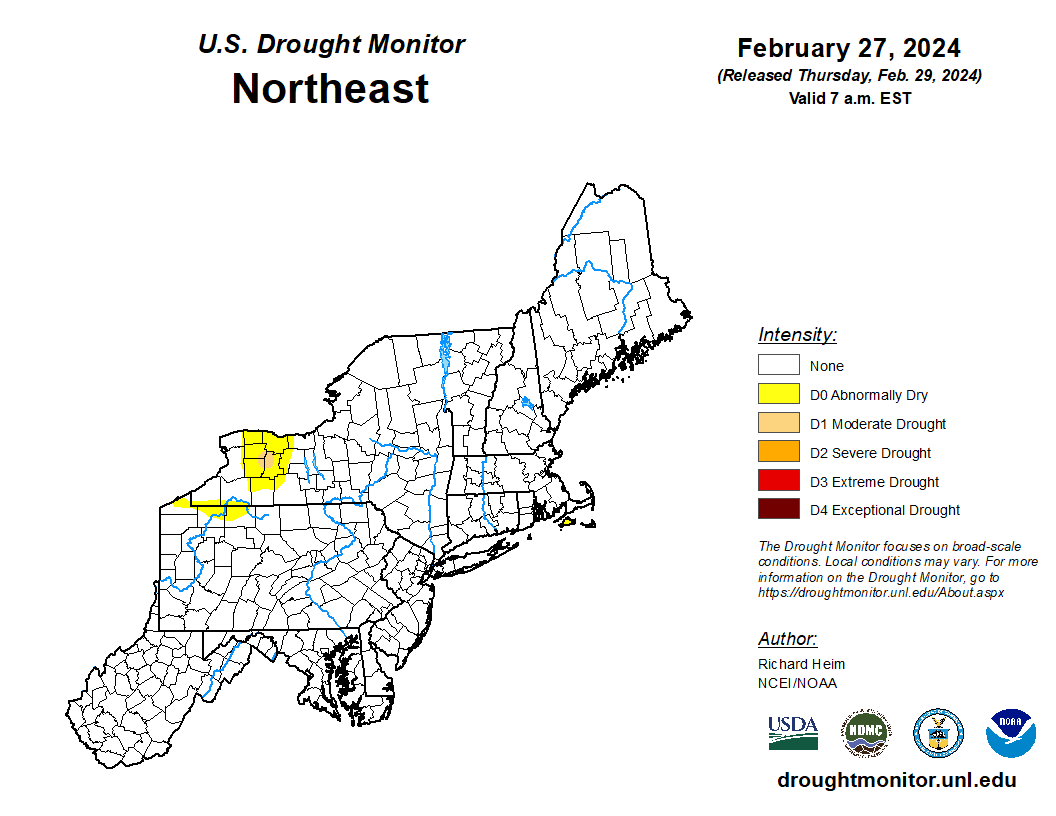
US drought monitor (NE US)
Forecaster: EPAWA Meteorologist Bobby Martrich
Discussion last updated: Friday March 8th, 10:00 AM
