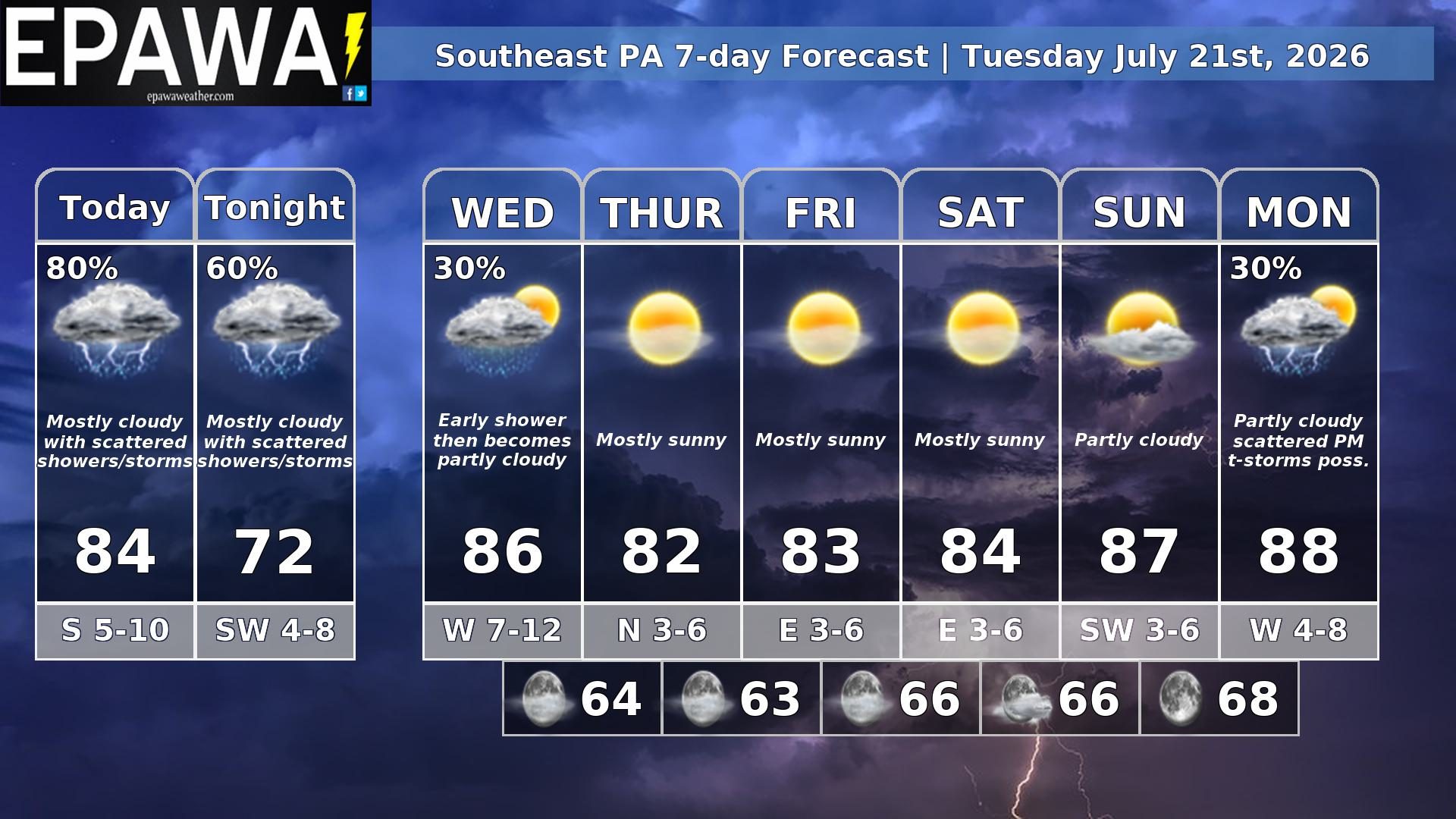
Our southeast PA forecast region includes Philadelphia, Doylestown, West Chester, Lancaster, York, Gettysburg & surrounding areas. Forecasts are updated daily M-F and Saturday that covers both weekend days.
Daily Forecast Video
Daily Forecast Discussion
Strong t-storms today for some areas…
Scattered showers and perhaps garden-variety thunderstorms are possible this morning near a warm front, then scattered potentially strong thunderstorms are possible mid-afternoon through mid-evening with a shortwave and its associated cold front moving through. Highs will reach the low to mid 80s this afternoon, then showers and storms continue overnight .
The front may be slow to exit and still lingering into early Wednesday with an early shower(s) threat, then a pleasant and low humidity airmass settles in the late week period. Partly to mostly sunny conditions likely continues into next weekend, but turning warmer late in the weekend and early next week ahead of a cold front, which will approach Monday with scattered PM thunderstorms possible.
Forecaster: Martrich 21 July 0300Z
Average high
Average low
Record high temp (year)
Record low temp (year)
88°F
70°F
103°F (1930)
51°F (1966)
*Climatology information is based off of Philadelphia, Pennsylvania