

EPAWA’s long range outlook is updated weekly every Friday morning before noon
Most recent update: Friday October 23rd, 11:10 AM

Technical discussion for advanced readers:
The technical discussion below will feature two (2) subcategories: Precipitation, and Pattern Discussions. Storm possibilities will be discussed exclusively in the Premium Forum with intense model analysis leading up to any major snow, ice, or rain events, not publicly. To join this discussion and hear the updated thoughts from our team, visit The My Pocket Meteorologist Page by clicking HERE and select the “Premium Weather Forum” option.
Precipitation Discussion
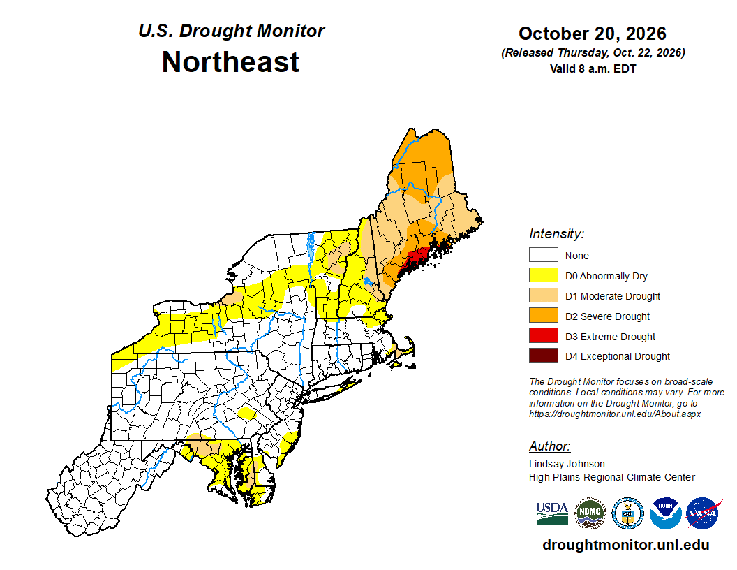
OVERVIEW: Aside from a small area in NW Maryland and Southern Franklin County (PA) as well as a part of the MD Eastern shore where a drought still exits, the remainder of the area is currently without a drought designation, and is largely unchanged from last week’s outlook. Precipitation over the remainder of this month is likely to be very little or none at all.
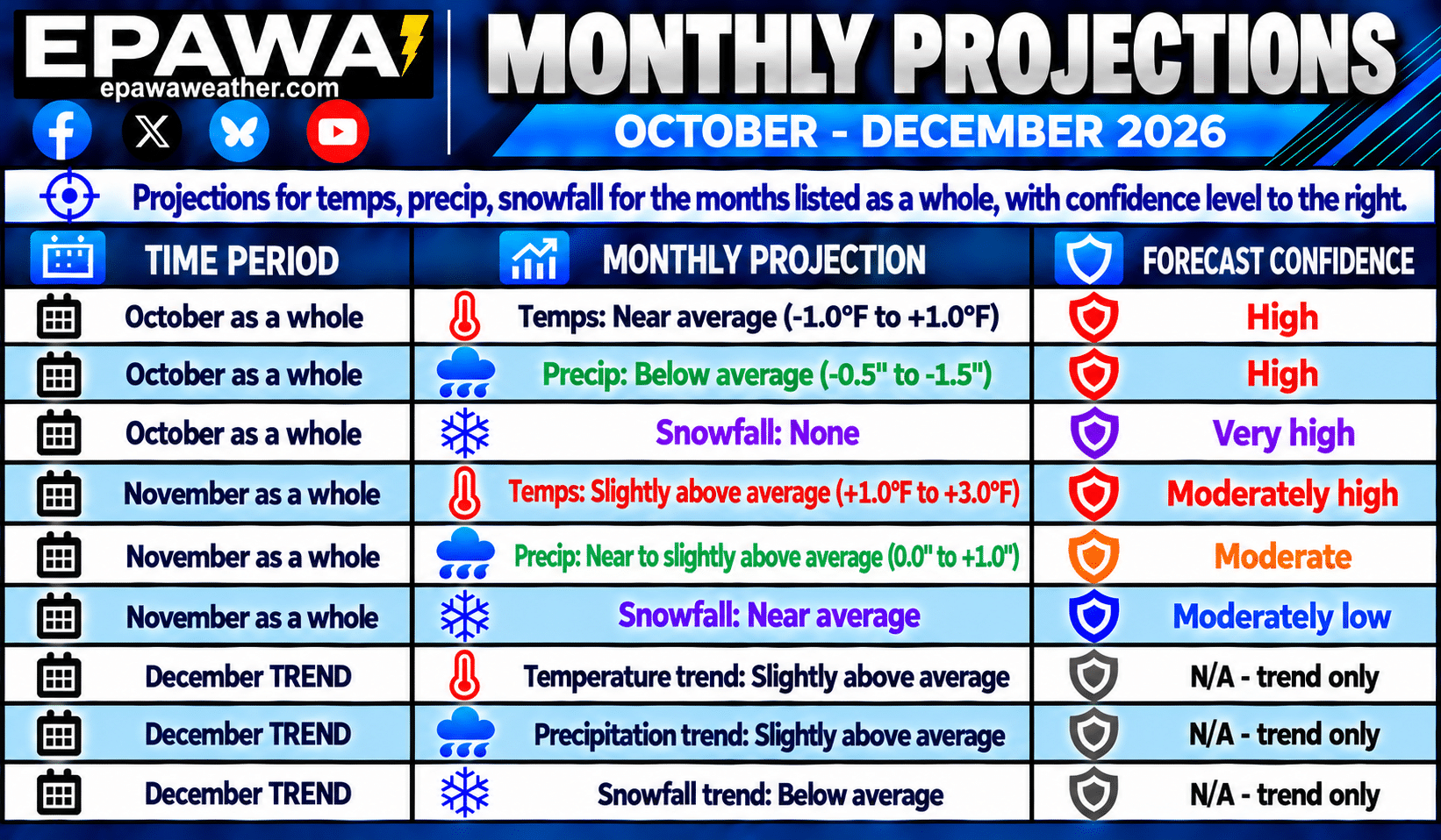
Our projection for October continues to be below average (-0.5″ to -1.5″) precipitation for the month as a whole. Without the remnants of Hurricane Isaias earlier in this month, many areas would be under a half inch in total month-to-date. No snow is expected, but October snowfall isn’t common for most of the area. The month of November projections were maintained this week for near to slightly above average (0.0″ to +1.0″) precipitation in accordance with longer term climate models and global observation trends, along with near average snowfall.
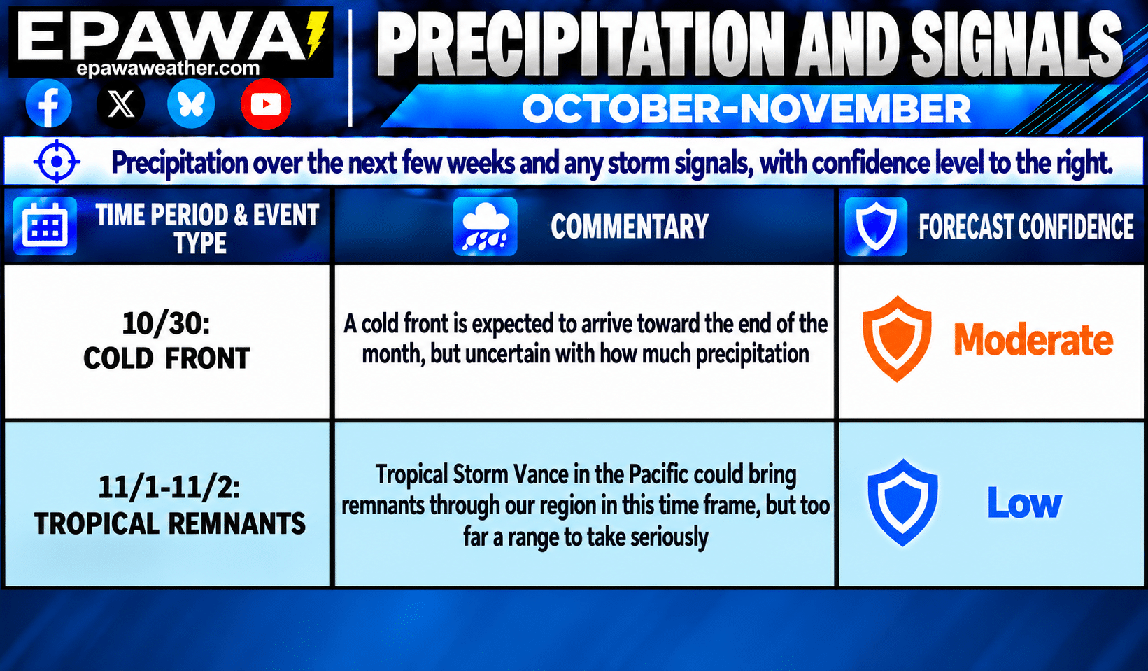
Shorter term, there are no modeled threats over the next week, continuing the extended dry period. A cold front will move through around October 30th, but may feature minimal or no precipitation at all. We then turn our attention to early November for the next rainfall possibility which could come in the form of tropical remnants from the [then] former TS Vance. Given the lengthy lead time and not all models on board, this is currently met with low confidence.
Breakdown of precipitation departures from normal over the next several weeks:
October 24th – October 30th: Below average
October 31st – November 6th: Near to slightly above average
November 7th – November 13th: Near average
November 14th – November 20th: Near to slightly above average
November 21st – November 27th: Near to slightly above average
November 28th – December 4th: Slightly above average
Public/free available maps will be updated when a threat is imminent for significant weather on the weather alerts page throughout the year: http://epawaweather.com/weather-alerts/
Note: Any image below is clickable for larger viewing
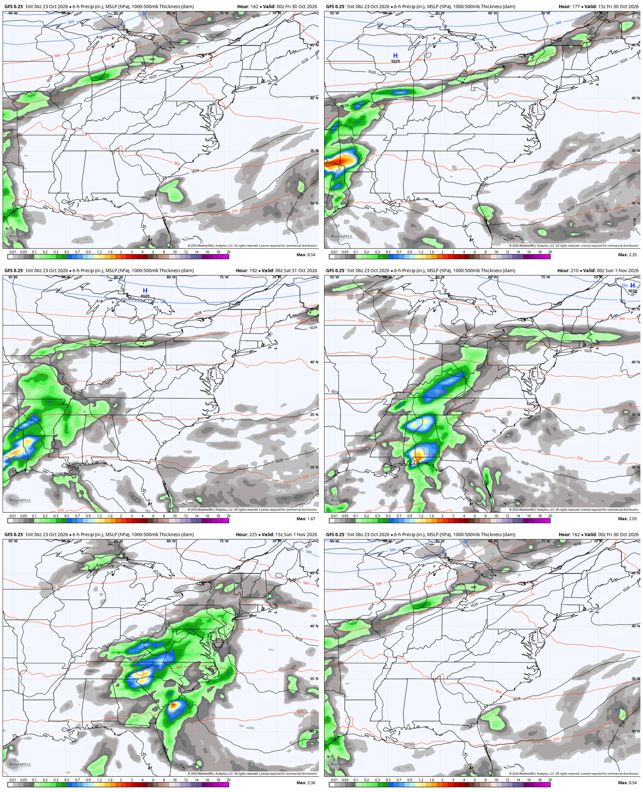
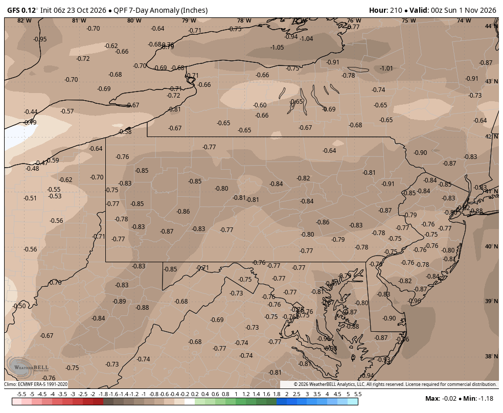
All models continue to suggest that very little or no rainfall is expected through the end of October, with perhaps a few showers in northern areas with the October 30th cold front.
Pattern Discussion
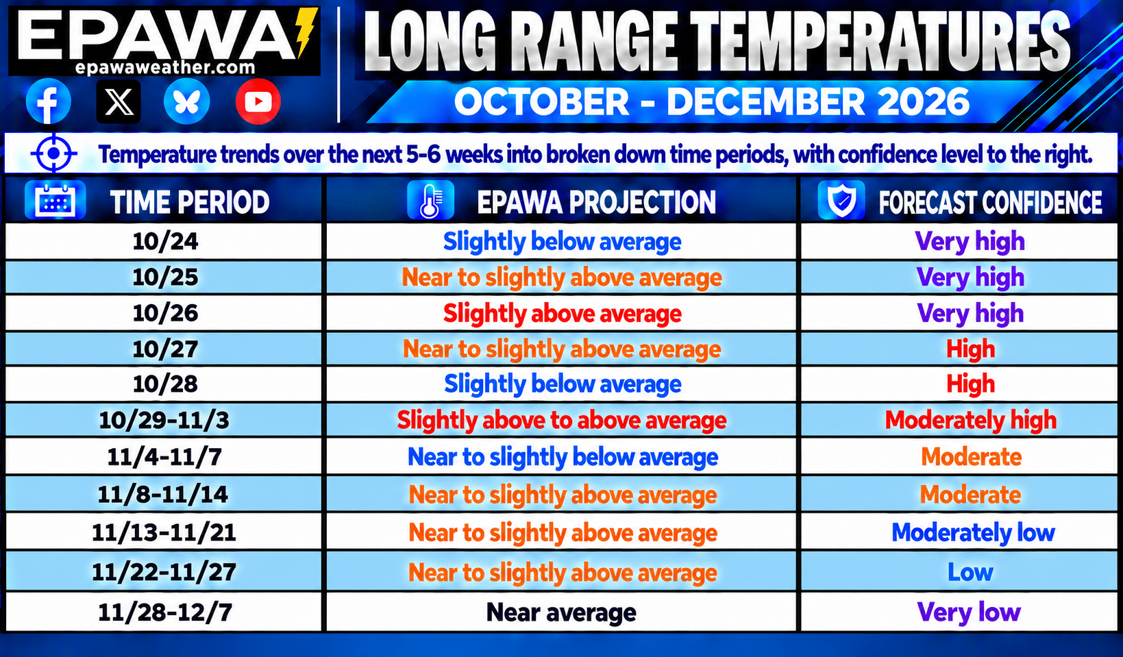
OVERVIEW: Our projection for October was maintained this week for a near average (-1.0°F to +1.0°F) temperature departure for the month as a whole, with the expectation of cooler than average days balancing the milder days over the remainder of this month. November projections were slightly adjusted this week to a slightly above average (+1.0°F to +3.0°F) temperature departure, using long term climate guidance and global observation trends.
- Seasonal changes are going to be become more noticeable in the weeks ahead as we continue to lower average highs/lows, and that downward process is now about a 3.0°F drop per week. Summerlike heat is now behind us, although temperatures reaching the 70° mark is not over quite yet, especially in SE areas. The expectation for November is for temperatures to be slightly above average as a whole, with most of the month fitting that narrative, and a return to near average late November and early December.
- The Madden-Julian Oscillation (MJO) is currently in the Circle of Death (COD) or NULL phase, and is expected to migrate into phase 1 in the coming days, then phase 2 by early November. The eventual pattern becomes more Pacific-driven, where temperatures are generally milder overall with a Pacific jet influence. This pattern is also rather zonal in nature, which brings more frequent precipitation events. Hurricane activity should remain limited at best with a strong El Niño increasing Atlantic shear despite reaching the peak of Atlantic hurricane season September 10th. Until Isaias became a hurricane earlier this month, it was the longest we’ve gone without an Atlantic Basin hurricane since 1966 in the modern satellite era. It’s also the longest stretch in the pre-satellite era since 1914, a season where no hurricanes were present, or at least none that were documented.
- A composite average of the Sea Surface Temperature Anomalies (SSTa) in the ENSO regions places it in strong El Niño territory currently. The following are Coral Reef Watch Sea Surface Temperature Anomaly values referenced in this context. From west to east across the Pacific, the Niño 4 (west-central Pacific) is currently the “coolest” region at +1.1°C, whereas the Niño 3.4 region (east-central Pacific) is currently at +3.3°C. The eastern regions of Niño 3 (east-central Pacific) is currently +4.3°C, and Niño 1+2 region (near the Peruvian coast) is at an astounding +5.3°C as of October 21st. A near-record strong El Niño Fall is likely to continue and peak in November, and currently East-based.
Average high temperatures are currently in the 61-67°F range from north to south across our coverage region, which is about 2°F lower than at this point last week. The drop off in temps will continue throughout Fall at about a 2-3°F per week drop. Any above or below average stretches listed in the outlook will be relative to seasonal norms at that time, and it is important to note that cooler/warmer periods will be relative to the time of year. For example, the slightly above to above average temperatures listed in the October 29th through November 3rd period features highs in the mid to upper 60s, coming at a time when average highs are in the upper 50s to lower 60s. Use the average highs/lows chart below providing transparency for what average temperatures are at each corresponding location through December 15th.
Note: Any image below is clickable for larger viewing
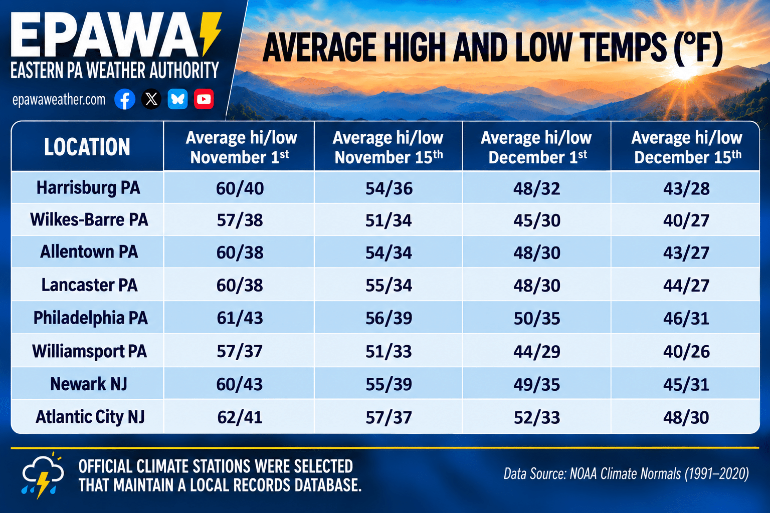
Average temperatures at our major climates stations across the region are shown over the next 6 weeks; average temps will drop at a much faster rate of ~3°F per week through Fall.
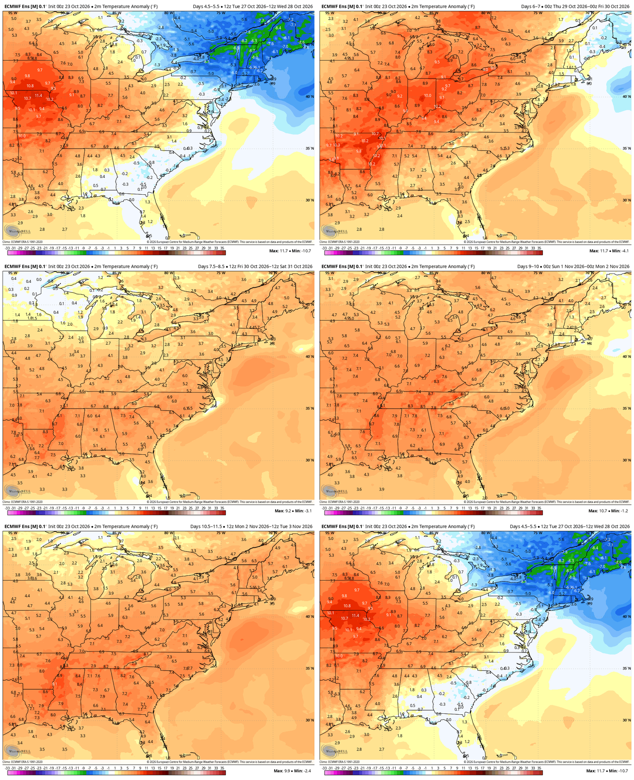
EPAWA's Long Range Projections
Projections last updated: October 23rd; next scheduled update: October 30th
Climate Prediction Center Products
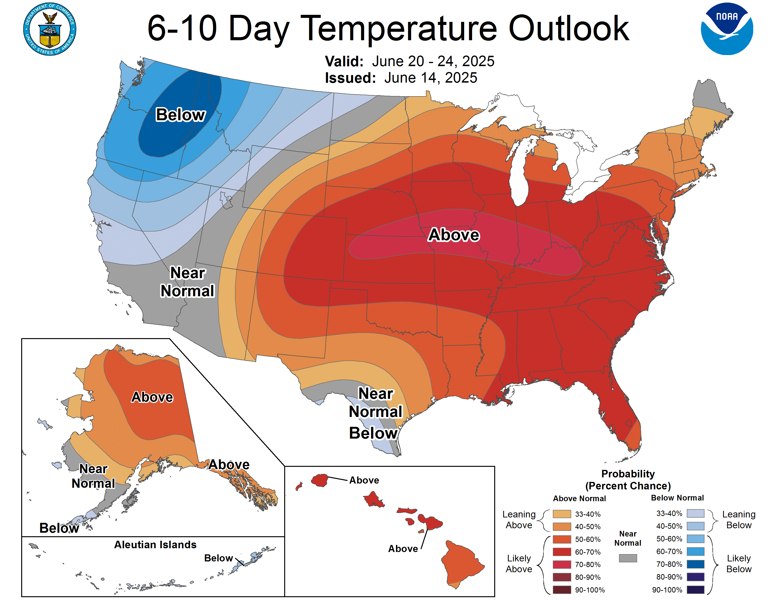
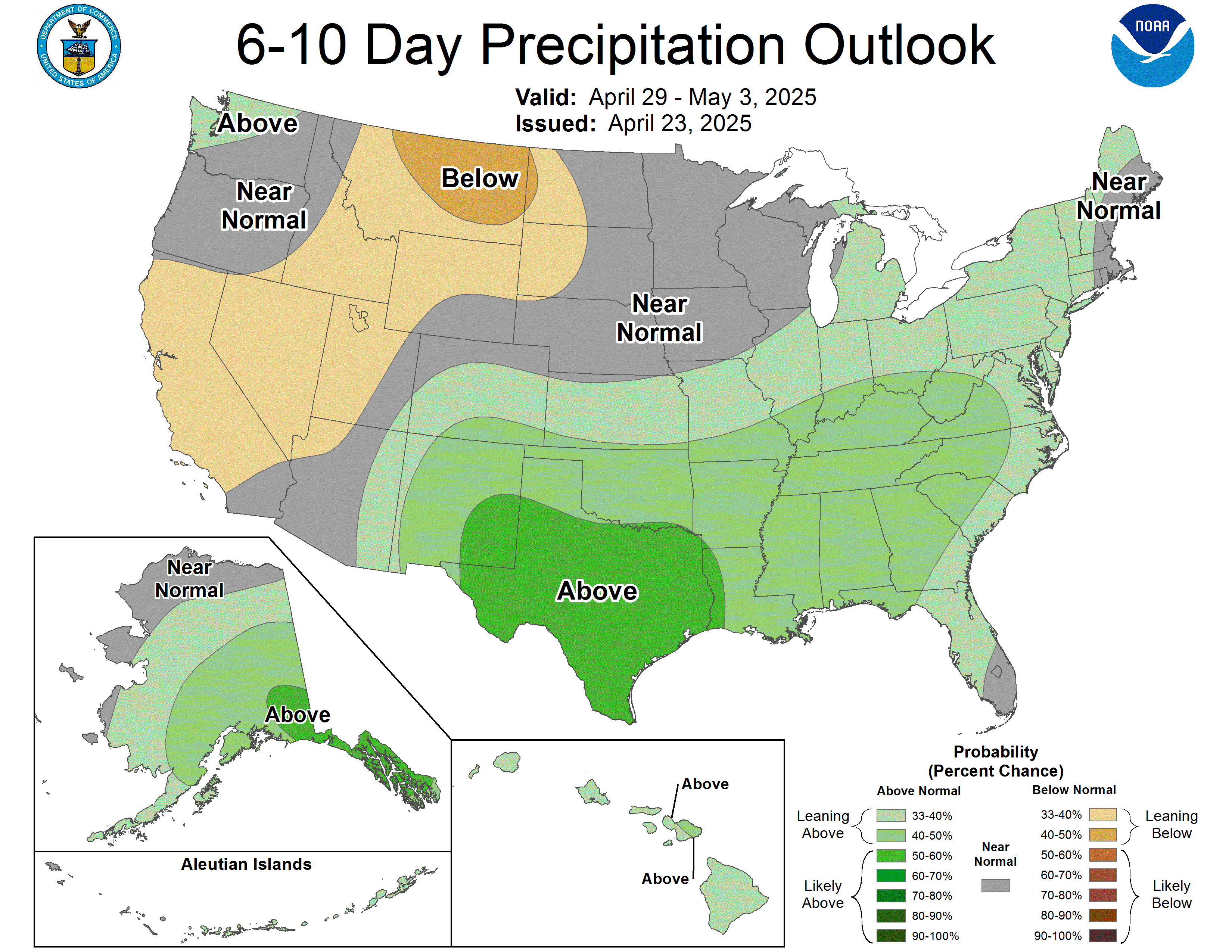
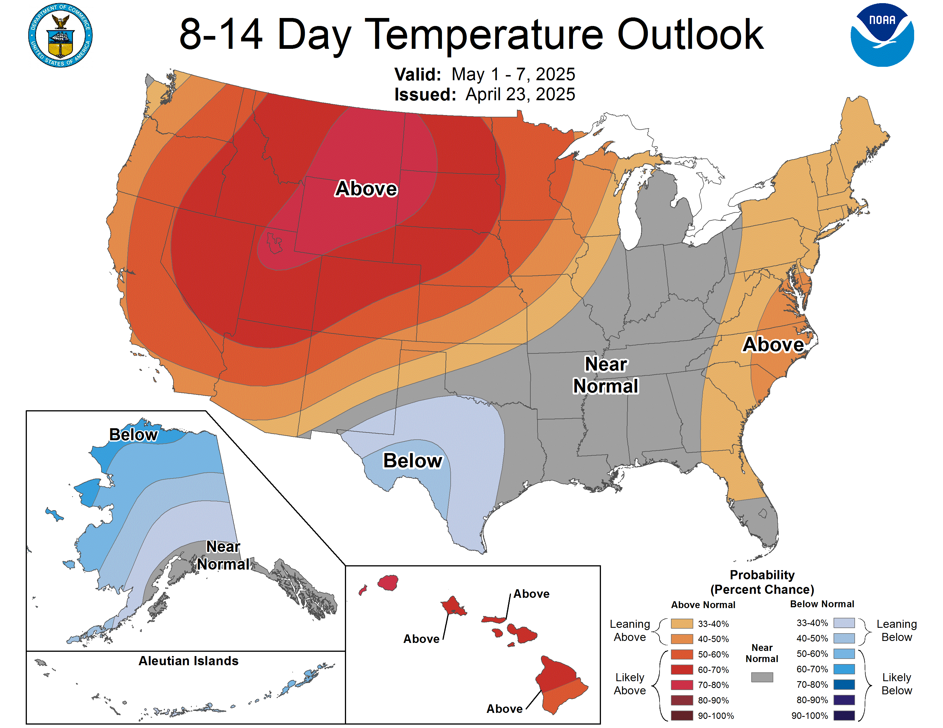
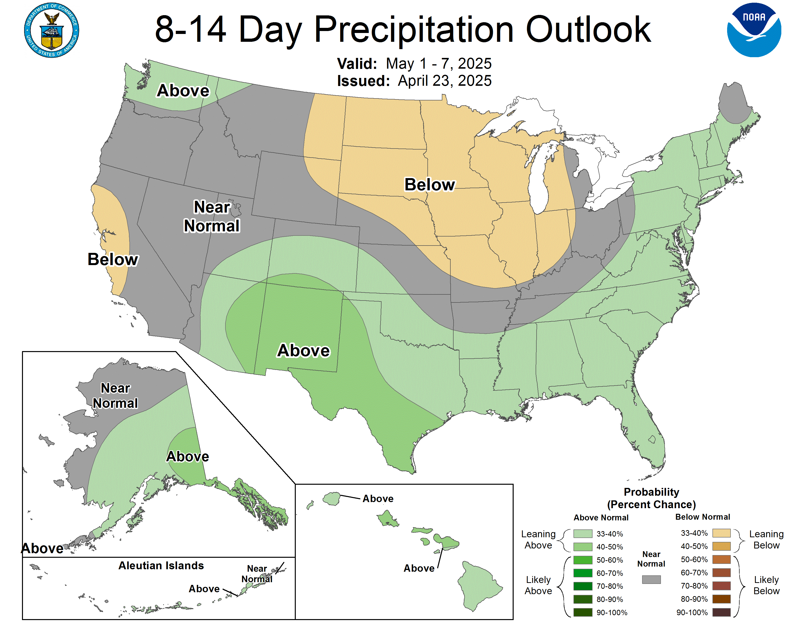
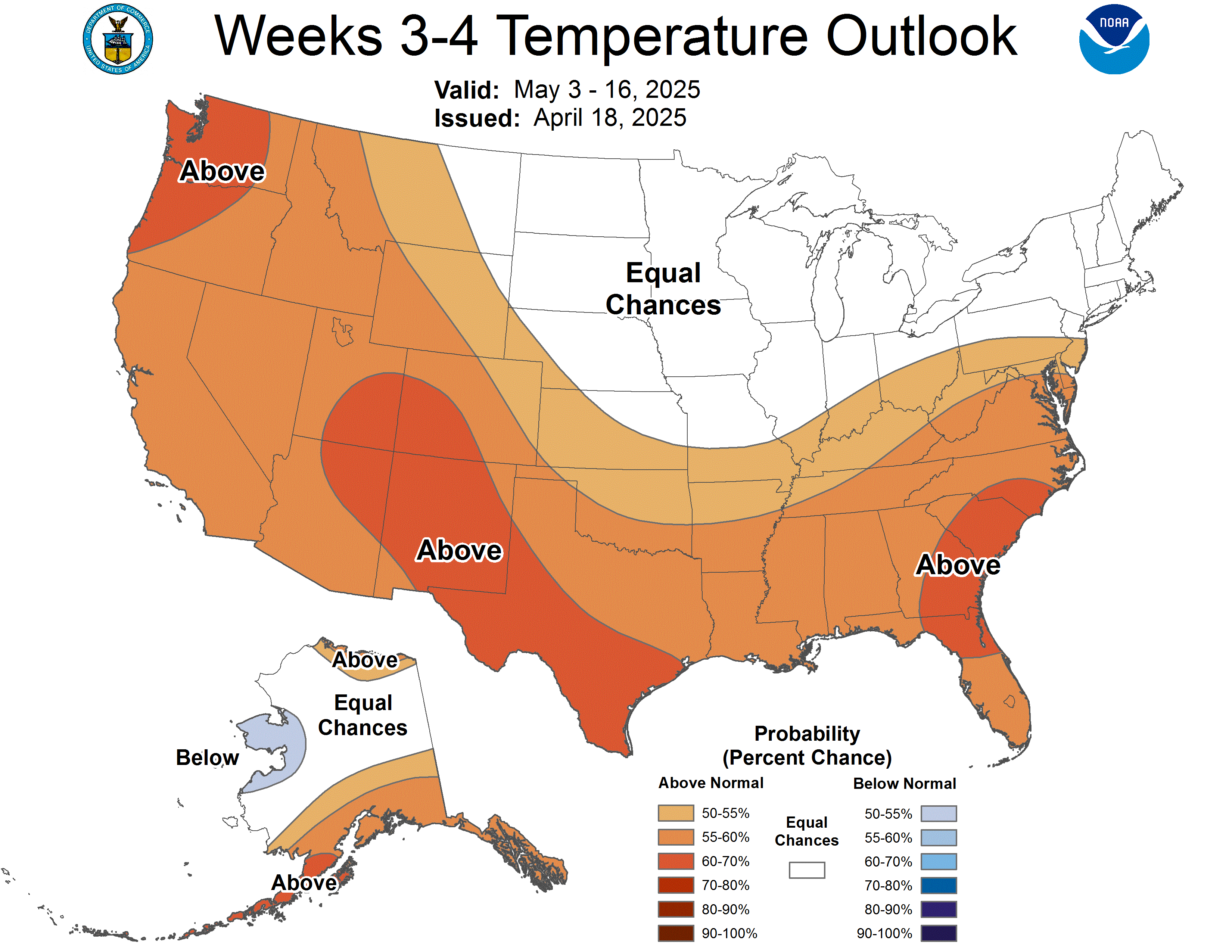
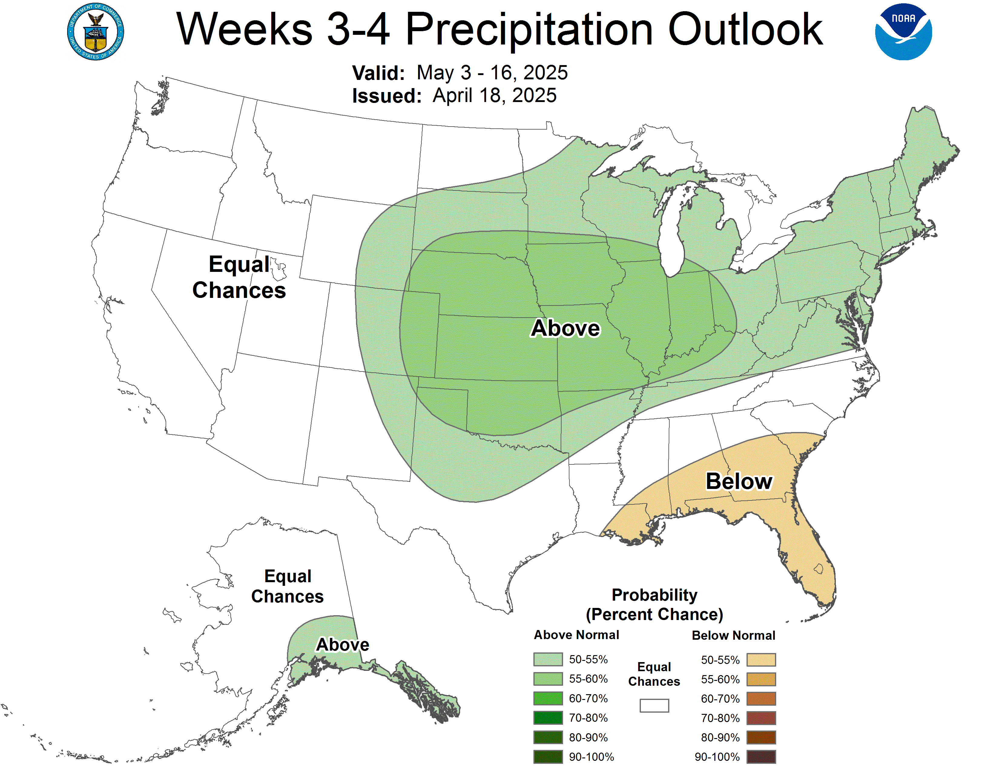
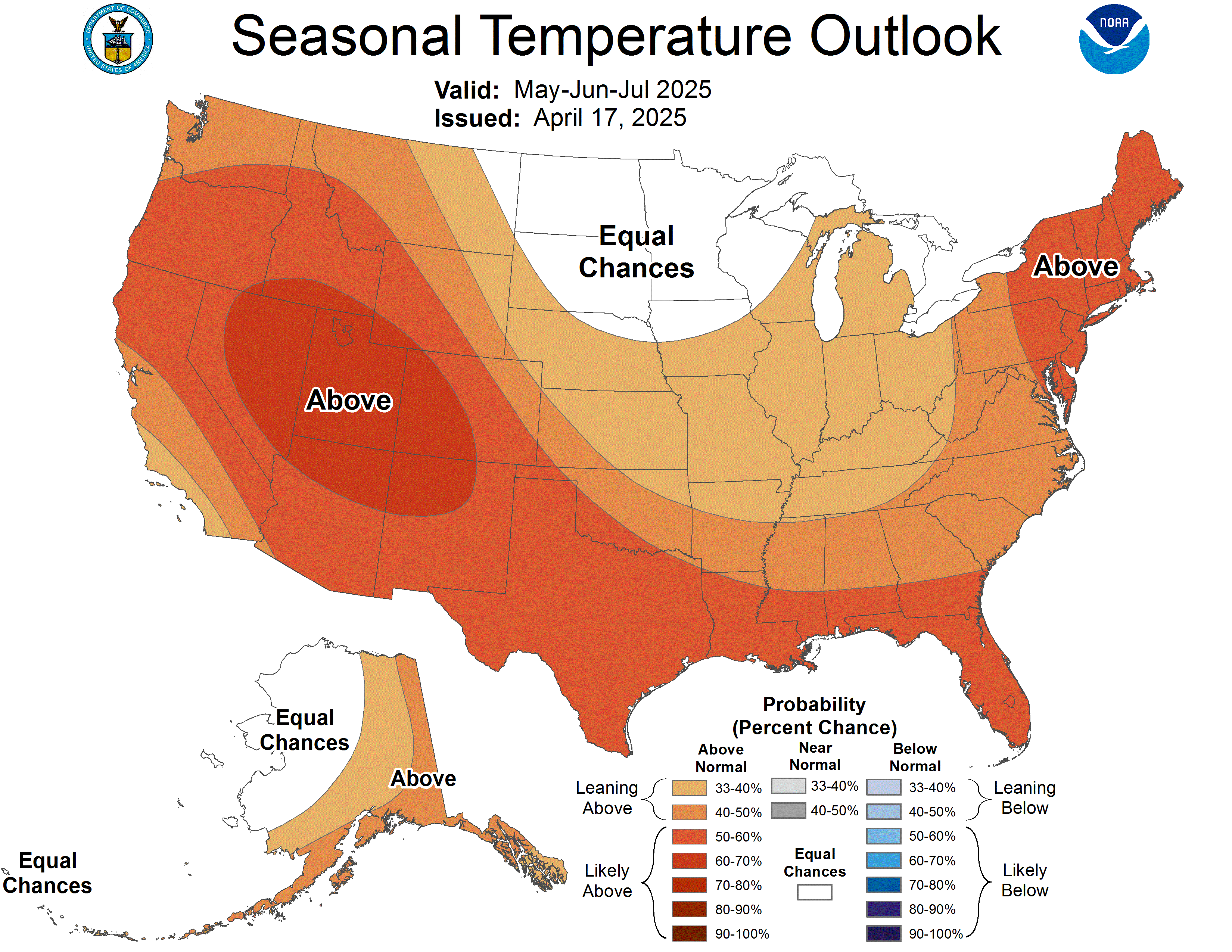
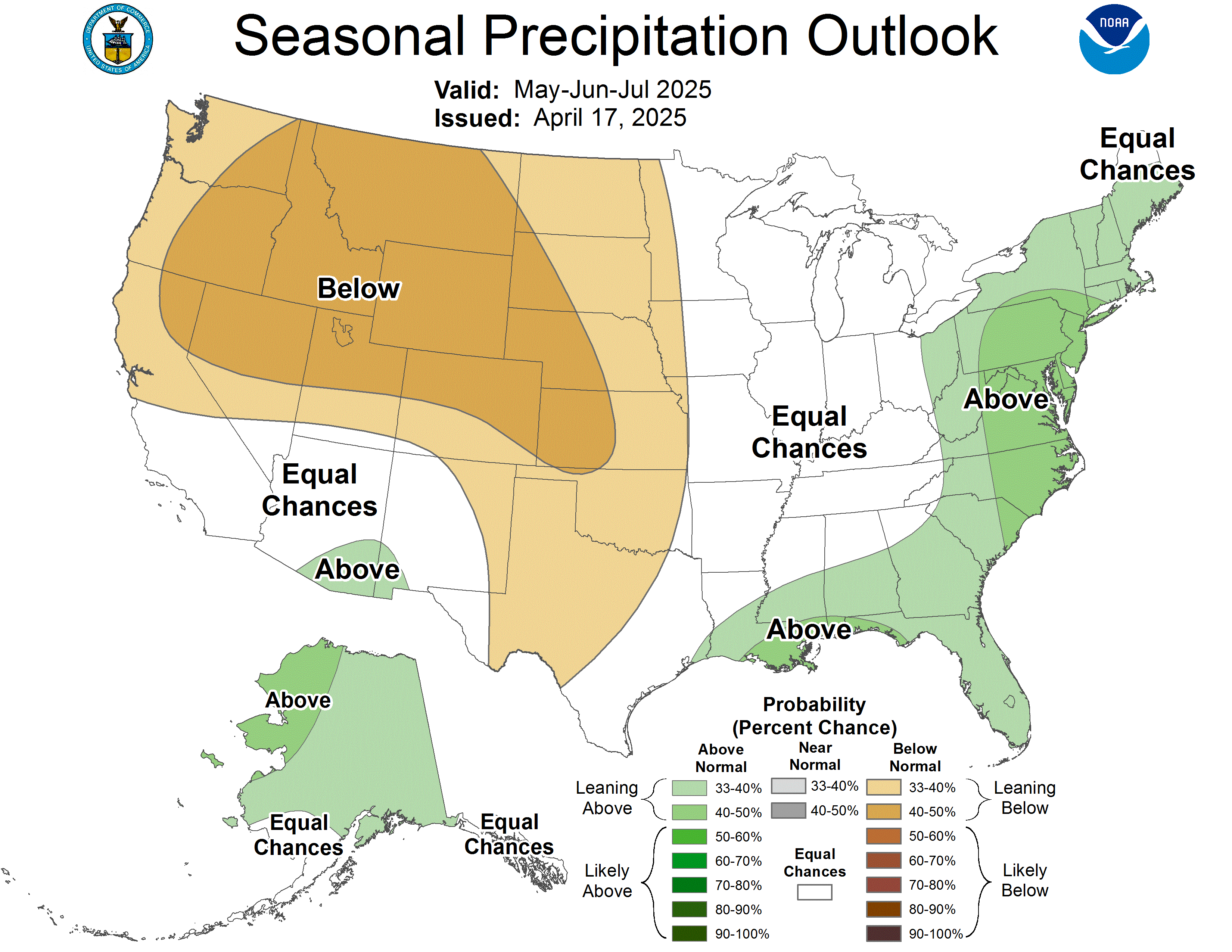
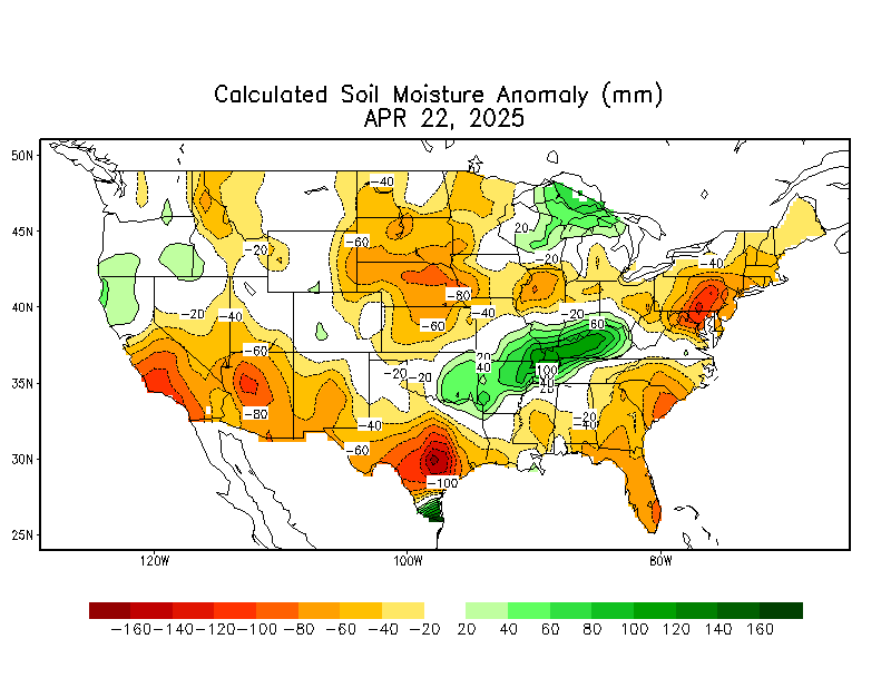
These products are from the NOAA Climate Prediction Center (CPC) and do not necessarily reflect the EPAWA forecast which is detailed above. All images below update automatically as the CPC releases new graphical products
Soil Moisture Anomaly
US Drought Monitor
Forecaster: EPAWA Meteorologist Bobby Martrich
Discussion last updated: Friday October 23rd, 2026, 11:10 AM