Our Northern NJ forecast region includes Bridgewater, Newark, Morristown, Sussex, Passaic, Union, Paterson & all surrounding areas. Forecasts are updated daily M-F, and Saturday that covers both weekend days – never on Sundays.
Daily Forecast Video
Daily Forecast Discussion
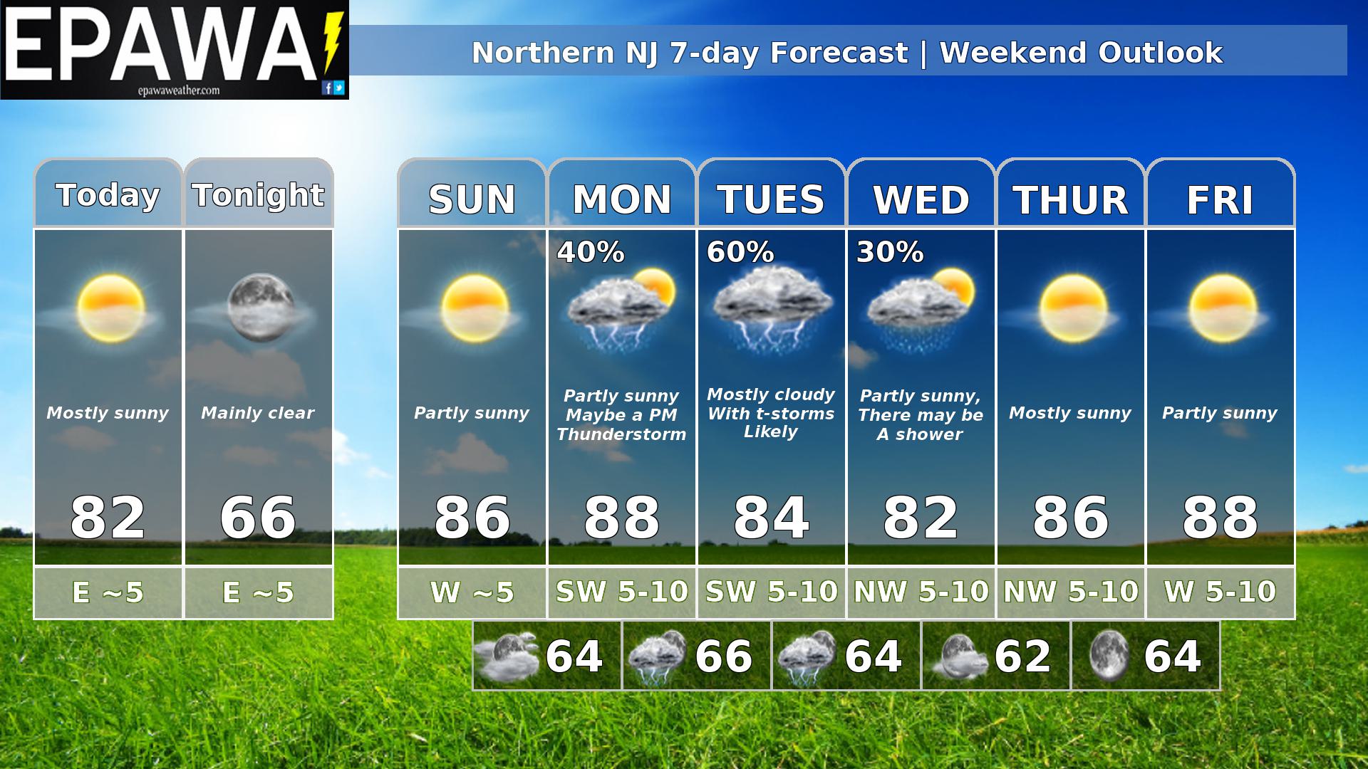
High pressure at the surface and a dry northwesterly flow aloft will bring us a very quiet and nice weekend. As we head into Monday, a shortwave through will be diving in for the northwest bringing us the chance for showers and thunderstorms in the afternoon. A surface low will form and move by to our N dragging a cold front through Monday night and Tuesday with thunderstorms becoming more likely. I added a shower back in Wednesday. The system moves out just slow enough that low heights and cyclonic curvature could make it just unstable enough. Then high pressure brings sunshine to end the work week.
Forecaster: Rinaldi 25 July 0015Z
Average high
Average low
Record high temp (year)
Record low temp (year)
87°F
70°F
102°F (2022)
53°F (1925)
*Climatology information is based off of Newark, New Jersey