Our Southern New Jersey forecast region covers the cities/towns of Long Branch, Toms River, Trenton, Cherry Hill, Barnegat, Camden, Vineland, Millville, Atlantic City, and Cape May
Daily Forecast Video
Daily Forecast Discussion
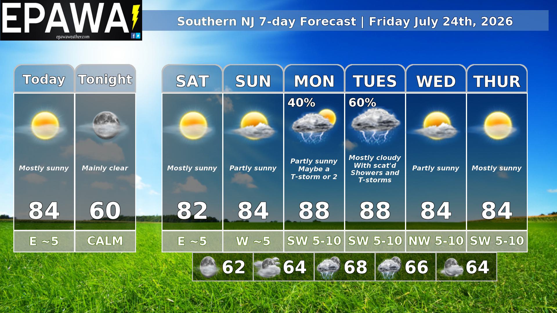
A spectacular day is in store with high pressure at the surface and a northwest flow aloft. That will bring us plenty of sunshine with a pleasantly warm afternoon and low humidity. Very nice conditions continue through the weekend. Then as we move into the new work week, a large trough starts headed our way. As heights start to fall Monday we may see a shower or thunderstorm, A cold front and shortwave Tuesday bring a better chance for thunderstorms. It now looks like things move along and Wednesday is dry as well as Thursday.
Forecaster: Rinaldi 24 July 0200Z
Average high
Average low
Record high temp (year)
Record low temp (year)
85°F
66°F
100°F (2011)
54°F (2007)
*Climatology information is based off of Mount Holly, New Jersey NWS office