Our Northern NJ forecast region includes Bridgewater, Newark, Morristown, Sussex, Passaic, Union, Paterson & all surrounding areas. Forecasts are updated daily M-F, and Saturday that covers both weekend days – never on Sundays.
Daily Forecast Video
Daily Forecast Discussion
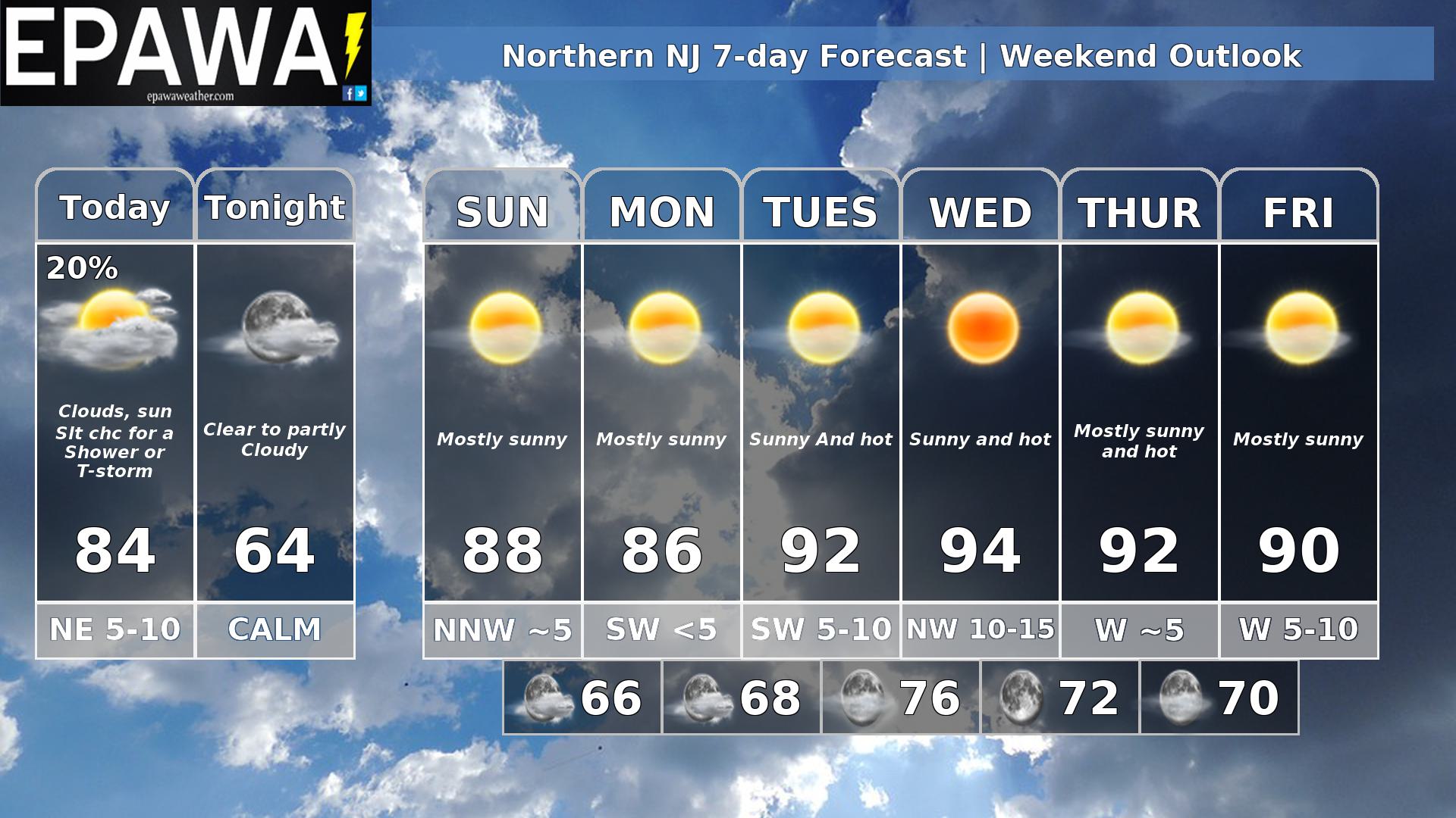
A front has pushed south of the area, but we’ll still have low heights aloft and we could see some isolated showers or maybe a later day thunderstorm, but most of the time will be rain free and thunderstorms will not be severe. After that a large area of high pressure builds in with the ridge coming in aloft and that’s going to mean an extended period of dry weather with the heat returning once again.
Forecaster: Rinaldi 11 July 0245Z
Average high
Average low
Record high temp (year)
Record low temp (year)
87°F
69°F
105°F (1993)
53°F (1909)
*Climatology information is based off of Newark, New Jersey