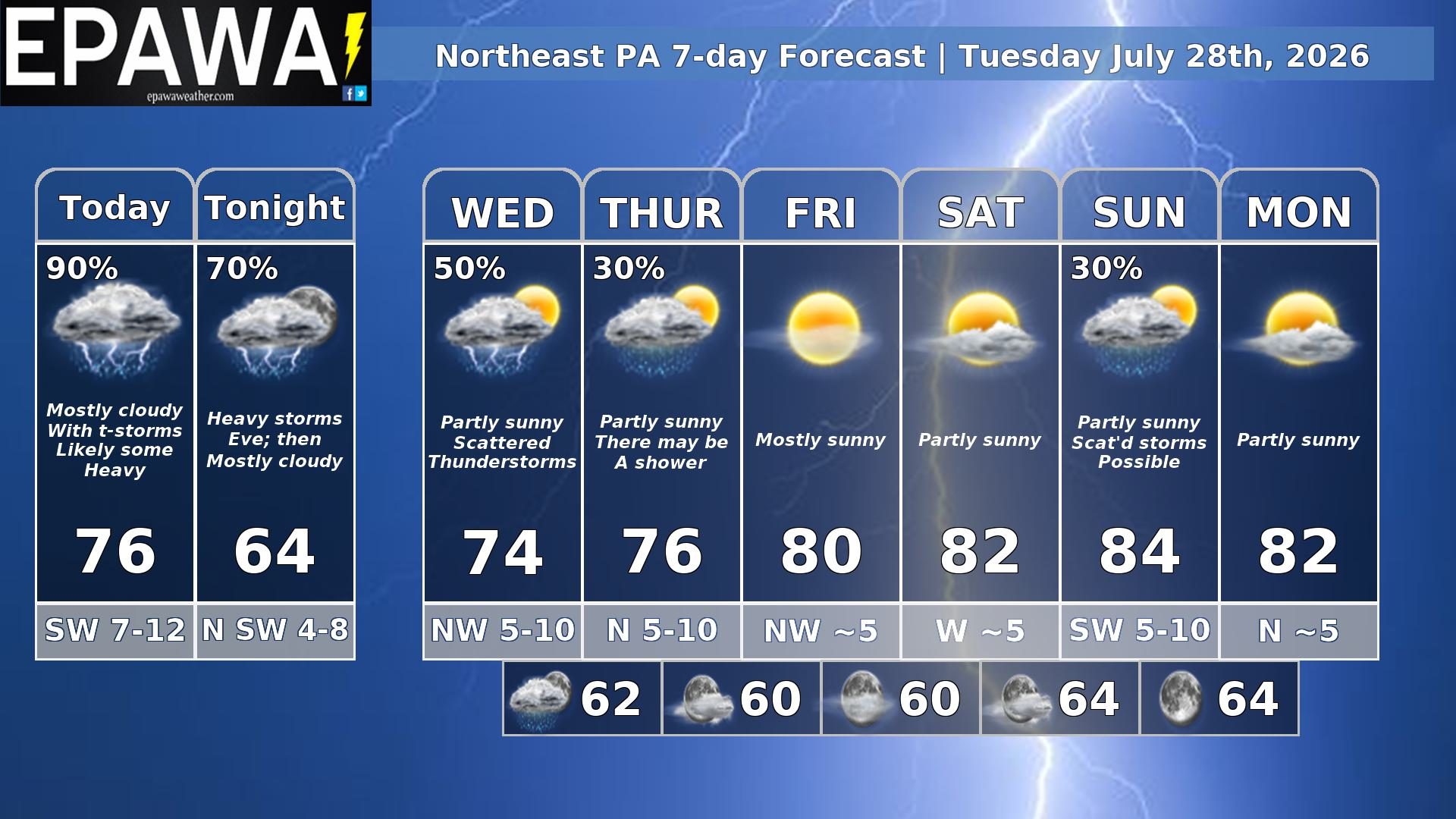
Our Northeast PA forecast region includes Scranton, Stroudsburg, Hazleton, Williamsport, Bloomsburg, Wilkes-Barre & surrounding areas. Forecasts are updated daily M-F and Saturday that covers both weekend days – not Sunday.
Daily Forecast Video
Daily Forecast Discussion
A vigorous upper-level shortwave and surface wave will combine to give us some unsettled weather today. I put thunderstorms in yellow. There is the possibility of severe weather, but it’s much more likely to our south. The system is slow to move out and with heights still low scattered showers and isolated thunderstorms will be possible tomorrow and isolated showers Thursday. Heights will still be low enough Thursday for lingering showers. We finally settle down Friday.
Forecaster: Rinaldi 28 July 0345Z
Average high
Average low
Record high temp (year)
Record low temp (year)
84°F
63°F
93°F (1931)
44°F (1903)
*Climatology information is based off of Scranton/Wilkes-Barre, PA