After a warm start to May, cooler temperatures will dominate for a few weeks…
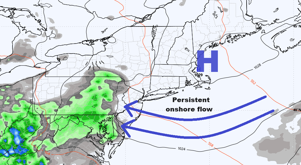
As is often the case during the month of May, the ebbs and flows of Spring yields signs of impressive warmth at times, but still has some cooler risks to contend with at times as well. Despite generally trending in the direction of warmer in May, there are many common features that are found year after year that can prevent sustainable warmth, and at the same time, provide some rather raw and dreary forecasts. The two “common features” that we’re referring to here are backdoor cold fronts and cut-off upper level lows. The weekend of May 4th and 5th will feature one of these backdoor fronts and an onshore/marine flow that will keep things raw, damp, and chilly relative to seasonal average. But the temperatures are expected to rebound through the work week…albeit temporarily so.
CLICK ON ANY IMAGE IN THIS ARTICLE TO ENLARGE FOR BETTER VIEWING
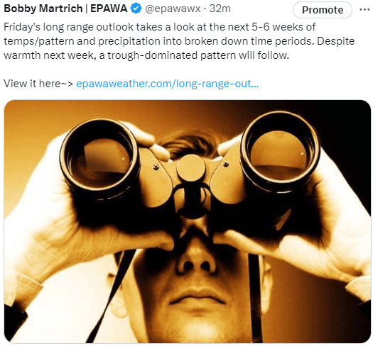
EPAWA’s long range outlook from Friday May 3rd from meteorologist Bobby Martrich expects a trough-dominated pattern for the core weeks of May between the 10th-24th
Click below to read the outlook:
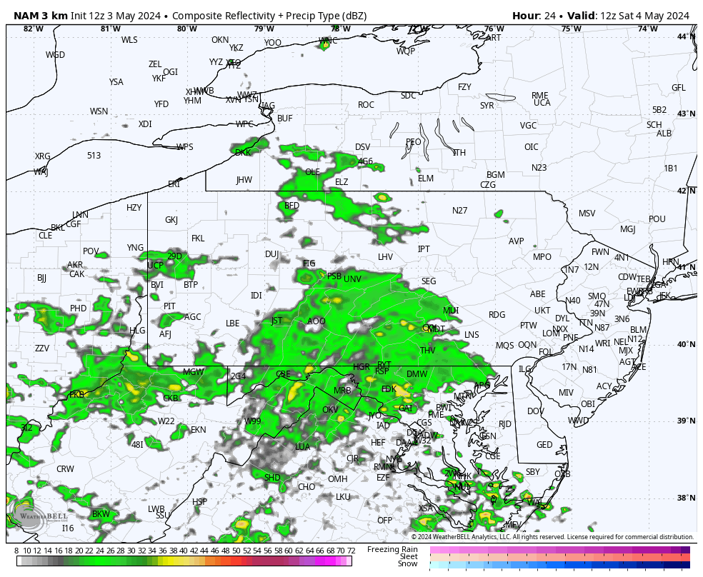
Taking a closer look at this weekend, showers with a cold front will advance into our area Saturday, but the front itself will be slowed by high pressure in the Gulf of Maine. This will lead to rounds of scattered showers both Saturday and Sunday, and the onshore flow will keep temperatures in the middle 50s to lower 60s across the region during this span. 3km NAM is below for the Saturday/Sunday period:
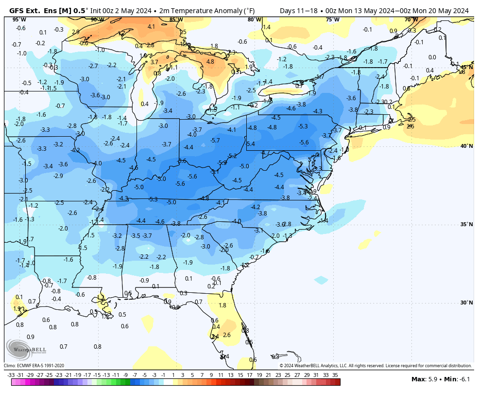
Once this system exits, it turns warmer on Monday, then progressively warmer through midweek. The warmer than average temperatures will be around through Thursday, then a near average Friday in transition to the cooler temperatures that follow behind. Unlike the previous up and down temperature pattern that was common since the 2nd half of April, the cooler trough-dominated pattern will likely be sustainable and last a couple of weeks, most notably between the 10th and 24th of May.
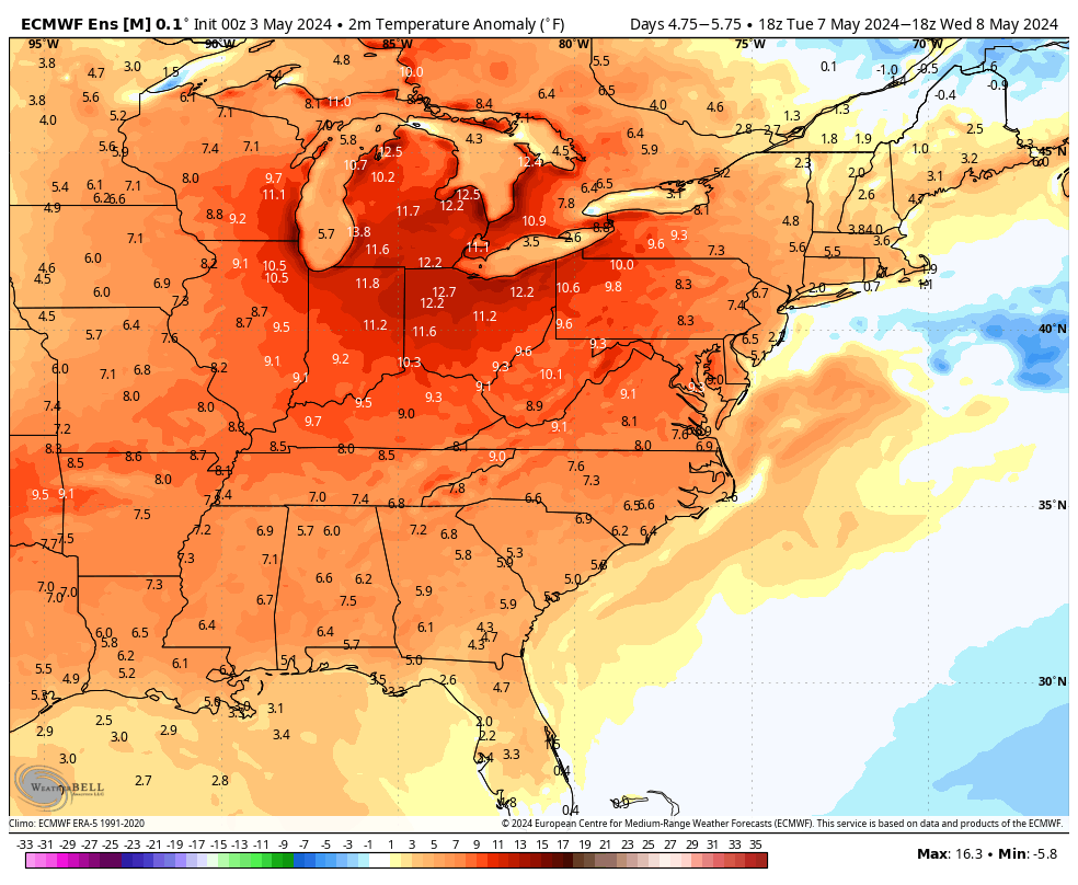
The European ensemble guidance shows the above average temps next week during the work week itself replaced by a trough and cooler than average temperatures settling in next weekend. Pattern will likely continue this way through about May 24th.
The GFS extended ensemble mean temperatures have the core of the cooler than average temperatures found in the week between May 18th and 24th, then gradually moderating relative to average once we near the end of the month (good news potentially for Memorial Day weekend) and then remaining near average or fairly close to it to begin the month of June:
Once in June, we expect that we will have transitioned from a weak El Niño background state to an ENSO neutral state, which in the Sumner months typically means warmer than average temperatures and wetter than average conditions. A La Niña will likely eventually be reached, but that may take until the end of the summer to be realized. The month of June may start off temperate/near average, but according to the EPAWA long range outlook issued on Friday May 3rd, there are warmer risks that may come into play for the 2nd half of June. We caught up with Bobby Martrich, the EPAWA long range forecaster who wrote this week’s outlook, and asked for clarification on that statement. “Normally we like to limit our long range outlooks to a 5-6 week lead time with accuracy in mind” he said. “But given the transition to ENSO neutral in June, there is the opportunity at least to see slightly above average temperatures during the 2nd half of the month. This will depend on overall progression of the background state and how quickly it starts running the overall pattern.” He also went on to say that he feels that July and August is more likely to feature above average temperatures, but very humid conditions as well. “Wetter conditions month to month since this past winter has been a recurring theme”, he stated, “I don’t see the wetter pattern letting up anytime soon, especially if we are headed into an ENSO neutral dominated pattern this summer.”
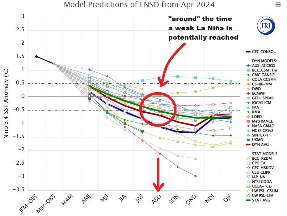
The model projections of ENSO from April 2024 suggest that while La Niña will eventually be reached, it may take some time getting there. ENSO neutral summers favor warmer conditions, but also wetter than a La Niña pattern.
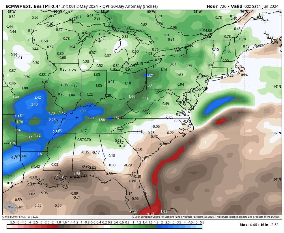
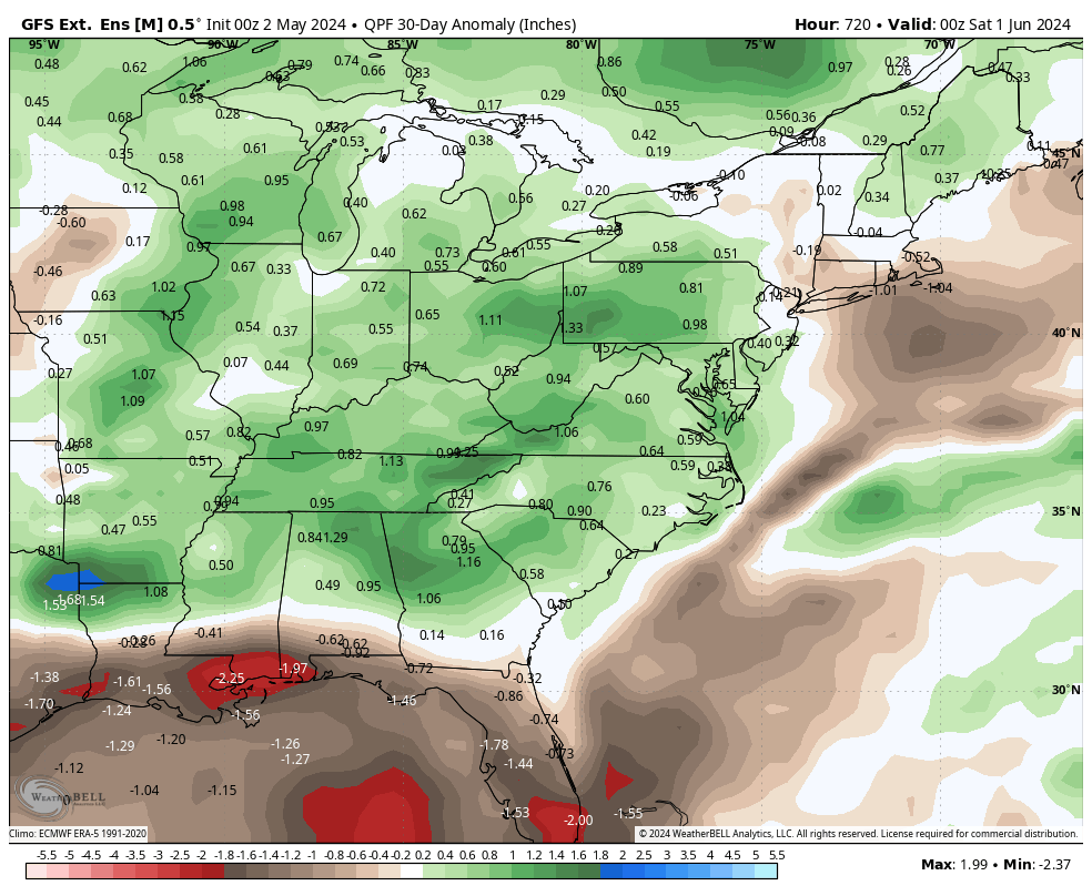
As far as precipitation goes, the near to slightly above average precipitation projection from EPAWA’s long range outlook is also largely supported by the longer-term climate guidance. Both the European EPS extended ensemble and GFS extended ensemble both show the same general idea. Wetter:
European/EPS extended ensemble for May 2024 (precipitation departure from average)
GFS extended ensemble for May 2024 (precipitation departure from average)
The wettest period of May looks to coincide with the expected trough-dominated pattern, so in this case it will be from the 2nd week of May through the entirety of the 3rd week of the month where precipitation will have its greatest impact on the month as a whole.