EPAWA's weekly Long Range Outlook

EPAWA's long range outlook is updated weekly every Friday morning before noon

Long range outlook last updated: Friday May 16th, 2025, 10:45 AM

Technical discussion is below for advanced readers:

Technical discussion below will feature two (2) subcategories: Precipitation, and Pattern Discussion. Storm possibilities will be discussed exclusively in the Premium Forum with intense model analysis leading up to any major snow, ice, or rain events, not publicly. To join this discussion and hear the updated thoughts from our team, visit The My Pocket Meteorologist Page by clicking HERE and select the "Premium Weather Forum" option.

Precipitation Discussion

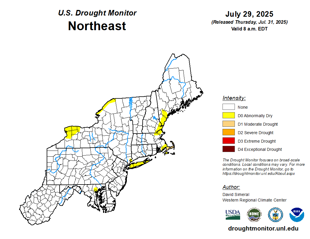
OVERVIEW: The US drought monitor (photo toward the bottom of this outlook) has been steadily improving for the most drought-stricken areas due to recent rainfall to begin the month. However this outlook is behind in data reporting and doesn't include the copious rainfall received within the past week for the interior locations. For this reason, I fully expect the drought map will look much different this time next week. For now, there is still a severe drought indicated in Berks and Southern Schuylkill, and much of York County in PA, and much of North-Central Maryland. Much of the remainder of the region is listed in abnormally dry to a moderate drought, but again, these areas we fully expect to improve given the recent rainfall that doesn't figure into this week's outlook. We adjusted projections for May this week to a solidly above average (up to +4.0") precipitation departure in the interior, and a slightly above average monthly precipitation anomaly in our southeastern areas with rainfall through the first half of May and more coming through the end of the month. The month of June projections were maintained this week for a near to slightly above average (+0.0" to +1.0") precipitation departure for the month. 

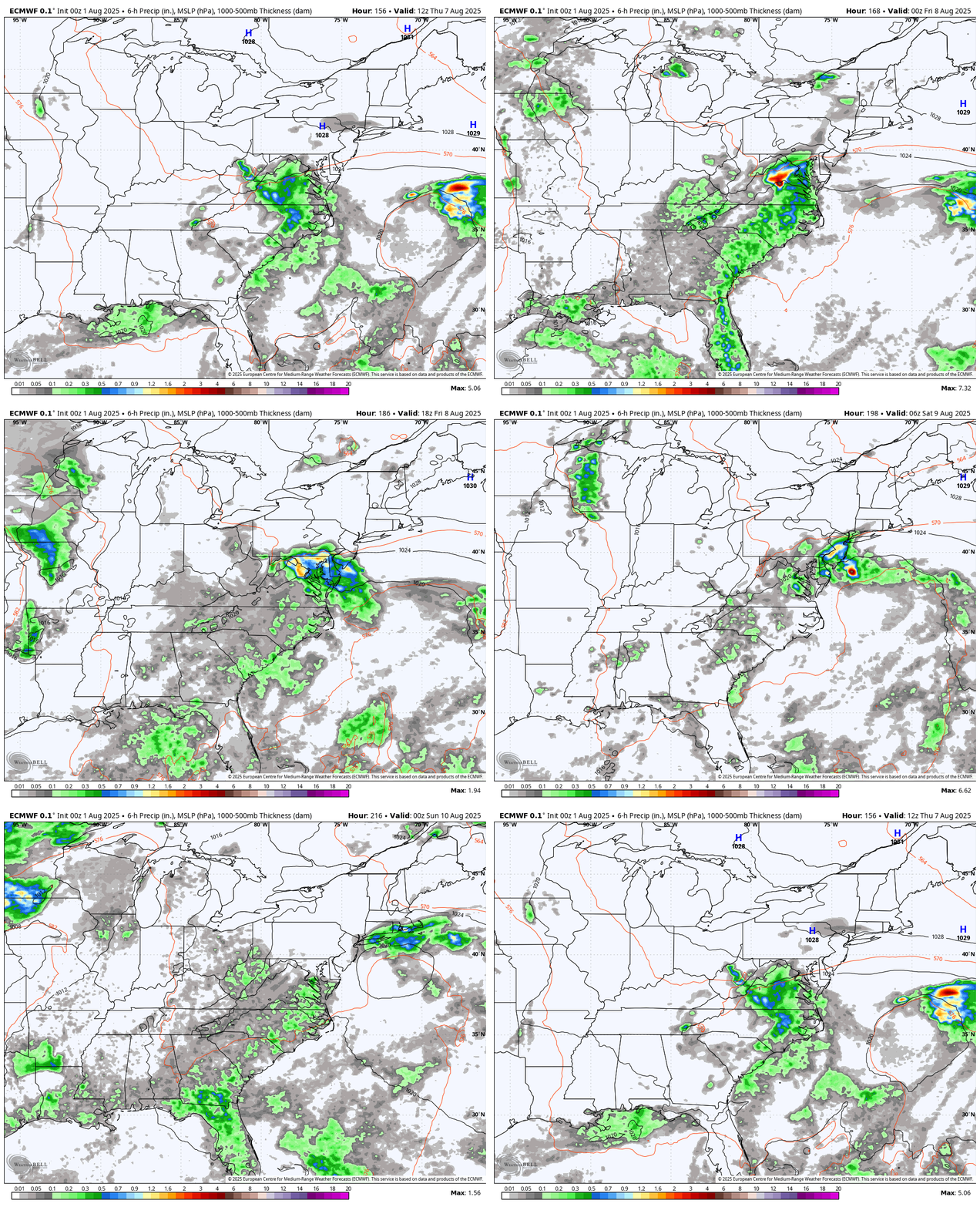
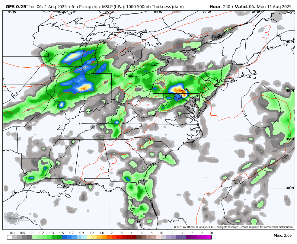
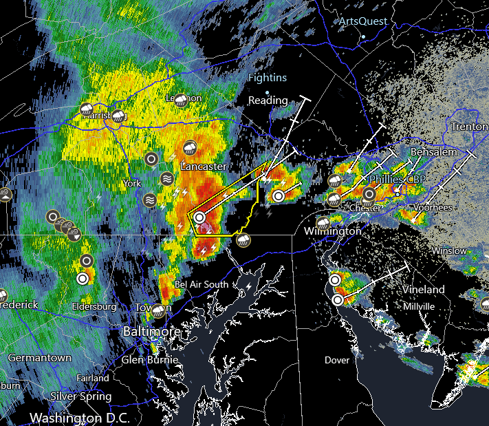
Shorter term, a warm front is crossing the region this morning with scattered showers and thunderstorms, then additional storms will follow later today and overnight. A pre-frontal trough moves through Saturday morning with a few showers in spots, then a cold front crosses the region Saturday evening. Most of this activity should be confined to Central PA, and with the best forcing well to the north, severe prospects will be limited at best in our area. A few days of a break in precipitation will follow the cold front, then a complex system follows midweek. This system will be upper-level low driven and is likely to get trapped under a Rex Block pattern, with high pressure over top of low pressure. This will lead to a multi-day unsettled period from Wednesday through the start of the Memorial Day holiday weekend. The most notable rain period appears to be Wednesday night through Thursday night, with additional intermittent showers lingering through Friday and Saturday until the system finally exits for [hopefully] a more optimistic forecast for the back half of the holiday weekend.

May's projection was adjusted this week for a solidly above average (up to +4.0") precipitation departure for the month as a whole in the interior with some of those areas through May 16th far exceeding what they'd normally see in an entire month with the rest of the month still to go. Southeastern areas will also finish with at least a slightly above average (+1.0"+) precipitation departure by month's end we project. The month of June projections were maintained this week for a near to slightly above average (+0.0" to +1.0") precipitation departure, using longer term climate models as well as seasonal trends. 

Breakdown of precipitation departures from normal over the next several weeks:

May 17th - May 23rd: Slightly above average

May 24th - May 31st: Near average

June 1st - June 7th: Near to slightly above average

June 8th - June 14th: Near to slightly above average

June 15th - June 21st: Near to slightly above average

June 22nd - June 28th: Near average


Public/free available maps will be updated when a threat is imminent for significant weather on the weather alerts page throughout the year:  http://epawaweather.com/weather-alerts/

Note:  Any image below is clickable for larger viewing  

A pre-frontal trough early Saturday morning may bring a few showers early on to some areas, then a cold front follows with scattered t-storms possible mainly in Central PA Saturday afternoon/evening
An upper level low is likely to get stuck underneath a Rex Block next week, leading to a multi-day rain and showers threat between Wednesday and next Saturday, along with well below average temps

Pattern Discussion

OVERVIEW:  The month of May projections were maintained this week for a near to slightly above average (0.0°F to +2.0°F) temperature departure as a whole. To this point of May temperatures are largely above average over most of the region, it appears that the back half of the month will feature slightly below average temperatures after May 17th, ultimately balancing the month somewhat as a whole to still lean to the slightly milder side of average overall. One notable extreme will be will an upper-level low influence beginning midweek next week, where several of those days may struggle to get out of the 50s. The month of June projections were also also maintained this week for a near average (-1.0°F to +1.0°F) temperature departure for the month as a whole, using long term climate guidance and seasonal/global observation trends. 

  • The Madden-Julian Oscillation (MJO) is currently in the Circle of Death (COD) or NULL phase, and is largely expected to remain there through the remainder of May and first half of June. Since tropical forcing is rather weak, it should favor more seasonable temperatures for the most part going forward, and less in the way of abrupt colder...or warmer extremes aside from mid-late week next week under an upper-level low and Rex Block influence. This likely sets the pattern for May to be rather seasonable overall after.

  • A composite average of the SST departures in the ENSO regions places it in ENSO neutral territory, and the Climate Prediction Center (CPC) has officially acknowledged that change recently. Any lingering La Niña background effects will continue to wane as we move through May. The Niño 1+2 region (eastern Pacific) had been the warmest of the 4 ENSO regions, but all other regions are now between -1.0°C and +0.1°C and solidly in ENSO neutral territory. The expectation is for ENSO neutral to remain throughout the Summer months, which typically favors slightly above average temperatures in the June/July/August 3-month period. Near average precipitation is typical of June and July, with a historically wetter than average month of August during ENSO neutral Summers within the past decade. 

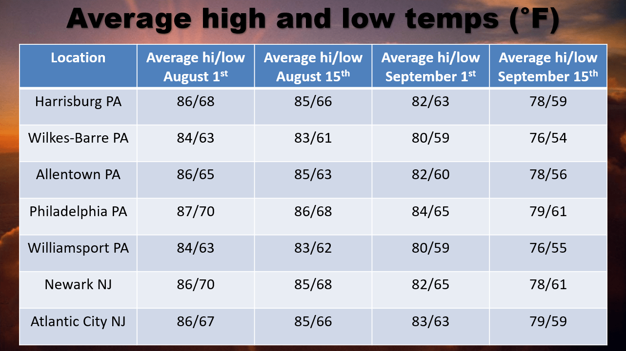
Average high temperatures are currently in the 72-74 °F range from north to south across our coverage region, which is about 1-2°F higher than at this point last week. Average high and low temperature increases will continue at about a 2.0°F gain per week throughout May and through the entirety of June. Any above or below average stretches listed in the outlook will be relative to seasonal norms at that time, and it is important to note that cooler/warmer periods will be relative to the time of year we are talking about. For example, the below to well below average temperatures listed for the May 21st-24th period generally features highs in the 50s to lower 60s, coming at a time when average highs are typically in the middle 70s. Use the average highs/lows chart below providing a point of reference and transparency for what average temperatures are at each corresponding location through July 1st.

The month of May projections were maintained this week for a near to slightly above average (0.0°F to +2.0°F) temperature departure as a whole, with temperature periods of slightly below average balancing out the warmer first half of the month over the remainder of May. The month of June projections were also maintained this week to a near average (-1.0°F to +1.0°F) temperature departure for the month as a whole, using long term climate guidance and global observation trends. 


Note:  Any image below is clickable for larger viewing

Average temperatures over the next 6 weeks are shown above at our major climate sites throughout the region, with temperature averages increasing two degrees per week now through early July
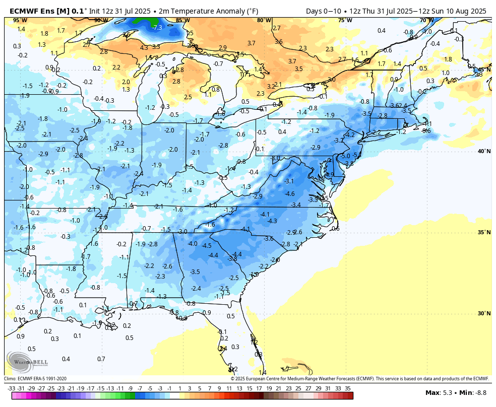
A "Rex Block" pattern sets up next week, which is characteristic of high pressure over top of low pressure, and traps the upper level low over our region for several days as a result next week

Long Range Outlook Table

Date(s)ThreatsSignificanceConfidence
5/17TemperatureAbove averageVery high
5/18-5/20TemperatureSlightly below averageVery high
5/21-5/24TemperatureBelow to well below averageHigh
5/25-5/28TemperatureSlightly below averageModerately high
5/29-6/7TemperatureNear to slightly below averageModerate
6/8-6/14TemperatureNear averageModerately low
6/15-6/21TemperatureNear averageLow
6/22-6/28TemperatureNear to slightly above averageVery low
5/17Cold frontA cold front crosses the region Saturday with scattered PM showers/storms in mainly Central PAHigh
5/21-5/24Multi-day upper level low influenceAn upper level low will get trapped under a Rex Block pattern (high pressure over low pressure) next week and brings a multi-day threat of showers and periods of rain beginning Wednesday. The most prominent rainfall period looks to be Wednesday night through Thursday night, then lingering intermittent showers with the upper level low through the start of the Memorial Day holiday weekend.Moderate
May as a wholeTemperatureNear to slightly above average (+0.0°F to +2.0°F)Moderately high
May as a wholePrecipitationAbove average, highest in the interior (+1.0" to +4.0")Moderately high
June as a wholeTemperatureNear average (-1.0°F to +1.0°F)Moderate
June as a wholePrecipitationNear to slightly above average (0.0" to +1.0")Moderate


Long range outlook table last updated: Friday May 16th, 10:45 AM. Next scheduled update: Friday May 23rd.

This is a weekly updated public long range guidance product from EPAWA. For daily long range updates and more detailed updates M-F, please join the EPAWA forum.

More information/sign-up at: http://epawaweather.com/mpm/ 

Climatology

*Indications of above or below average temperatures in the table above are relative to what is considered "normal" using data collected over the long term for a particular date. This is collected and maintained by the National Climatic Data Center in conjunction with the National Weather Service actual data from previous years collected at official ASOS/climatology stations across our coverage area. Also note that as time moves forward into a different period as shown above, average temperatures for those dates will also change. See the example below using Philadelphia, PA as the climo station:

DateAverage Hi/Lo (°F)Current EPAWA projection
May 17th75°F/55°FAbove average
May 24th77°F/57°FBelow to well below average
May 31st79°F/59°FNear to slightly below average
June 7th81°F/61°FNear to slightly below average
June 14th83°F/64°FNear average
June 21st85°F/66°FNear average
June 28th87°F/68°FNear to slightly above average

The departure from normal uses the average temperature for the date, averaging temps over 24 hours for any given location, using both high and low temperatures hourly during any particular day. This outlook determines warm vs. cool periods relative to normal temperatures.

Climate Prediction Center (CPC) Graphical Products

These products are from the NOAA Climate Prediction Center (CPC) and do not necessarily reflect the EPAWA forecast which is detailed above. All images below update automatically as the CPC releases new graphical products

CPC 6-10 day temperature outlook
CPC 6-10 day precipitation outlook
CPC 8-14 day temperature outlook
CPC 8-14 day precipitation outlook
CPC weeks 3-4 temperature outlook
CPC weeks 3-4 precipitation outlook
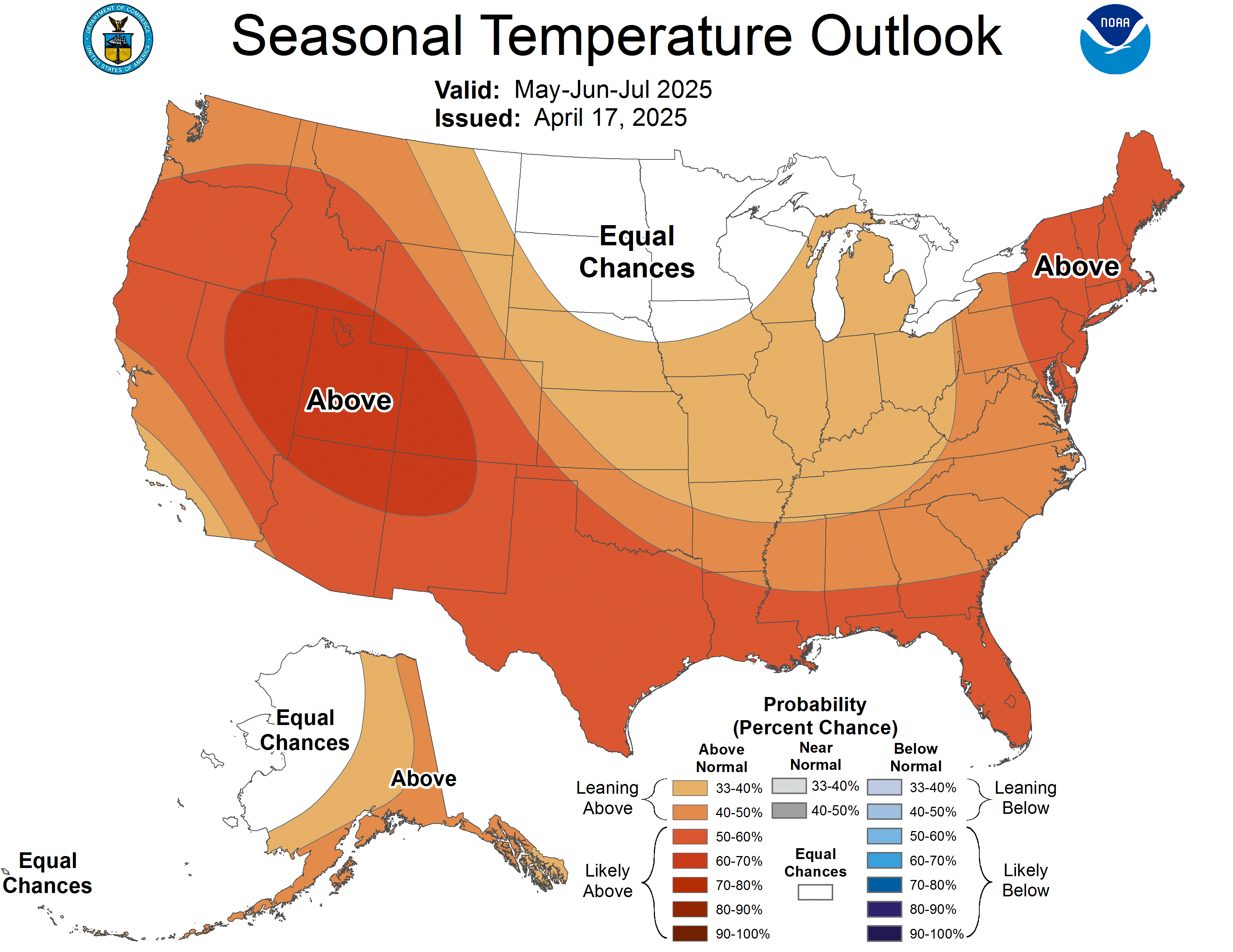
CPC next 3 months temperature outlook
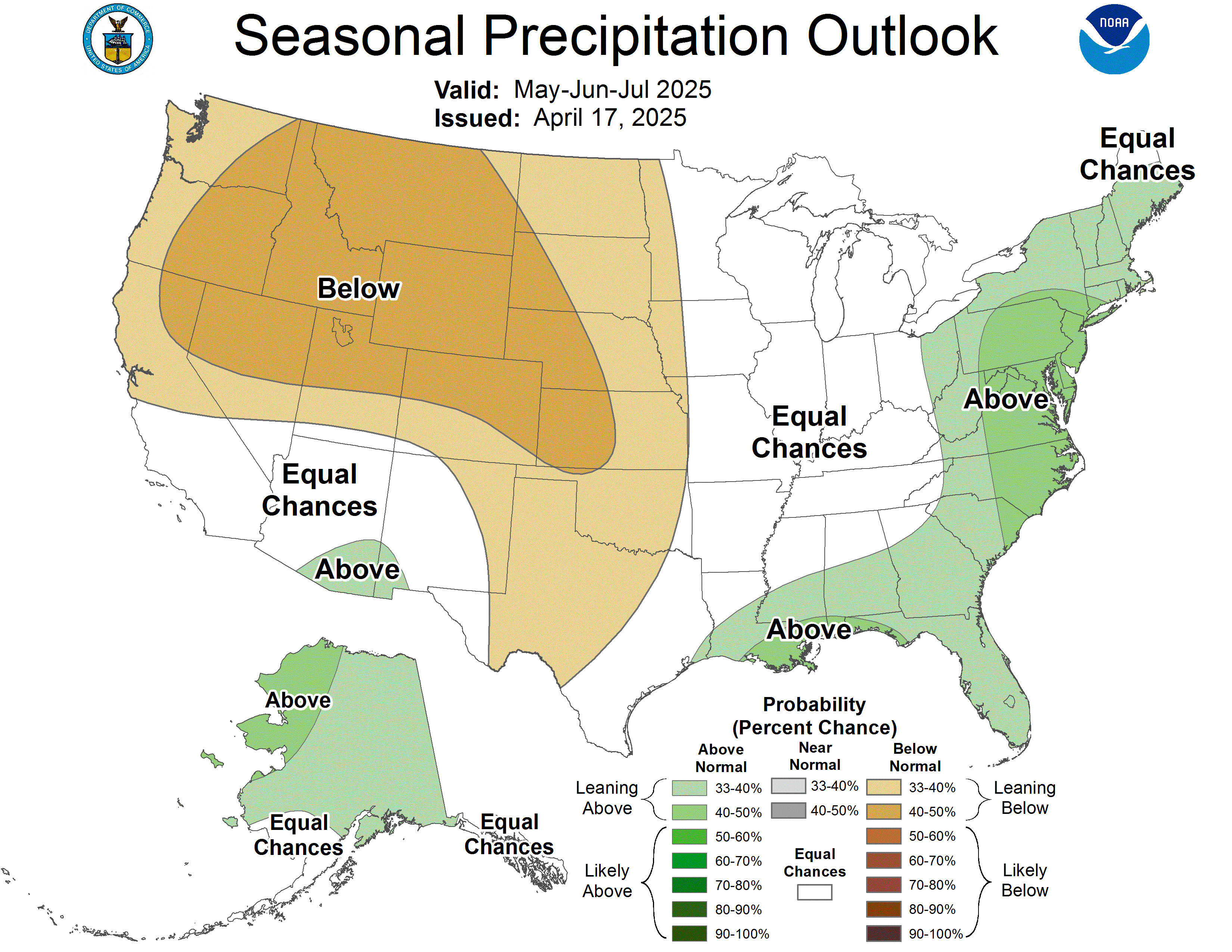
CPC next 3 months precipitation outlook

U.S. Soil Moisture Anomaly

Below is a look at the latest Soil Moisture Anomaly for the Contiguous United States. This is used by NOAA/CPC for the purpose of drought monitoring and drought outlooks. This image will automatically update daily.

US drought monitor (NE US)

Current Conditions

Interactive Radar

Long Range Outlook

Weather Alerts and Maps

Our Sponsors

Forecaster: EPAWA Meteorologist Bobby Martrich
Discussion last updated: Friday May 16th, 2025 10:45 AM