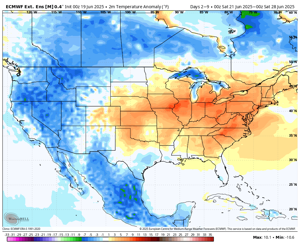
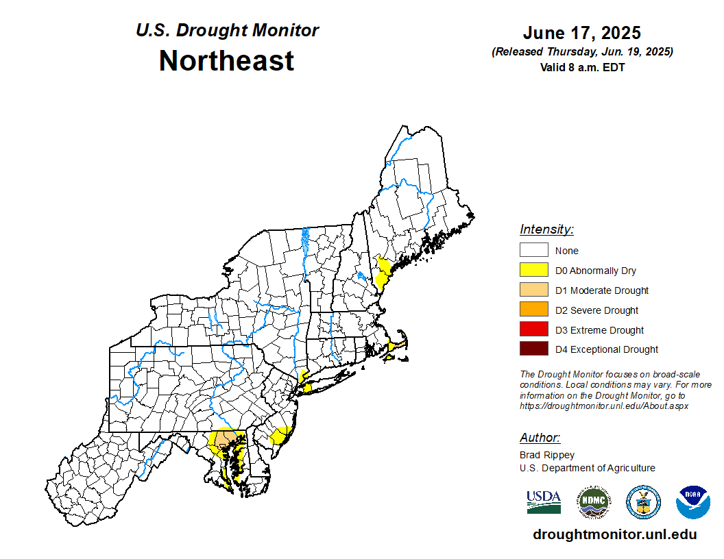
OVERVIEW: The US drought monitor (photo toward the bottom of this outlook) had been steadily improving over the past month or so, and there remains NO drought areas noted within our Pennsylvania, New Jersey, or Delaware locales. One moderate drought area remains over Baltimore and Harford Counties in Maryland, otherwise much of Maryland has also improved significantly. This is largely due to quite an impressive month of May with a top 5 rainfall month all-time in some locations, and generally near average precipitation continuing thus far in June. We maintained projections for June this week to a near average (-0.5" to +0.5") precipitation departure for the month as a whole. Most areas are generally near average currently for the month, and a few chances at thunderstorms over the final week of the month should allow most places to maintain near average precipitation. The month of July projections were also maintained this week for a near to slightly above average (+0.0" to +1.0") precipitation departure for the month as a whole. with a wetter 2nd half of the month vs. the first half.
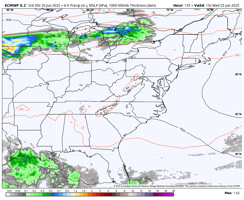
Shorter term, strong upper-air ridging will be moving in over the weekend, and maintains through at least early next week, leading to dry and very hot conditions. As the ridge begins to break down midweek and shift to the SW, the extreme heat will abate some and it will invite diurnally-driven thunderstorm activity into the region Wednesday and Thursday afternoons along a surface trough around the outer periphery of the retreating ridge. Aside from isolated thunderstorms in between, the next organized activity will likely follow at the end of the month with scattered thunderstorms ahead of a cold front.
June projections were maintained this week to a near average (-0.5" to +0.5") precipitation departure for the month as a whole, with the expectation of drier conditions until midweek, then isolated to scattered and diurnally-driven thunderstorm activity for the remainder of June. The month of July projections were also maintained this week for a near to slightly above average (+0.0" to +1.0") precipitation departure, using longer term climate models as well as seasonal trends. We expect a near average (overall) first half of the month, then slightly wetter than average during the 2nd half of July presently.
Breakdown of precipitation departures from normal over the next several weeks:
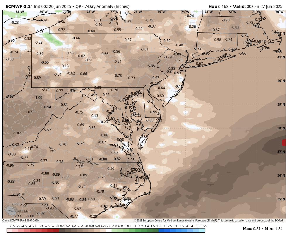
June 21st - June 27th: Below average
June 28th - July 4th: Near to slightly above average
July 5th - July 11th: Near average
July 12th - July 18th: Near average
July 19th - July 25th: Near to slightly above average
July 26th - August 1st: Near to slightly above average
Public/free available maps will be updated when a threat is imminent for significant weather on the weather alerts page throughout the year: http://epawaweather.com/weather-alerts/
Note: Any image below is clickable for larger viewing