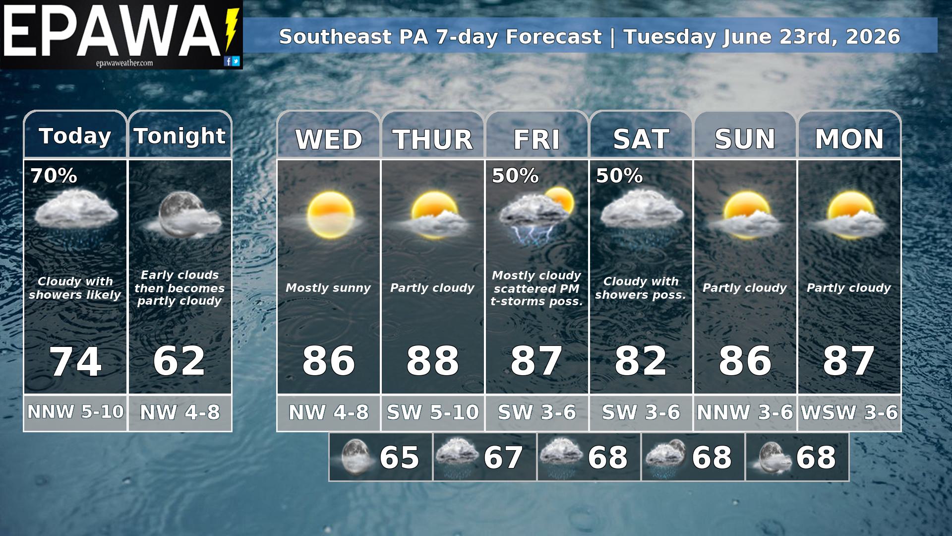
Our southeast PA forecast region includes Philadelphia, Doylestown, West Chester, Lancaster, York, Gettysburg & surrounding areas. Forecasts are updated daily M-F and Saturday that covers both weekend days.
Daily Forecast Video
Daily Forecast Discussion
Showers slow to move out Tuesday…
The big change in today’s forecast is that yesterday’s system will get hung up over the area, and another piece of upper level energy will maintain showers over the region Tuesday. It will come to an end from NW-SE, but will be very slow to do so. Some partial clearing is possible in the evening, then this system finally fully clears overnight.
A mostly sunny day is expected Wednesday with near to very slightly below average temperatures maintaining. The end of the week could turn unsettled with a cold front approaching. We kept partly cloudy skies in the forecast for Thursday, then scattered PM t-storms are possible on Friday as the front moves through. While there remains some uncertainty of whether a trailing shortwave follows the front and brings a showery Saturday, more models today are on board for that idea, and we increased confidence as a result. Returning to partly cloudy skies on Sunday and early next week.
Get My Pocket Meteorologist year-round text alerts and the EPAWA premium forum and be ready for all impactful weather events. Alerts are NOT automated and are sent by our team of meteorologists directly to your cell phone for the areas that you care about! Visit https://epawaweather.com/mpm/ for full details and sign up today!
Forecaster: Martrich 23 June 0300z
| Average high | Average low | Record high temp (year) | Record low temp (year) |
| 86°F | 66°F | 99°F (2025) | 47°F (1963) |
*Climatology information is based off of Philadelphia, Pennsylvania